Vaults, pavements, pots and sealings: closing the New Kingdom town season

6 weeks have passed since we started work in SAV1 East and SAV1 West – today, we managed to finish the final tasks in the field and with the coming week we will move to the New Kingdom cemetery SAC5; work in the cemetery will keep us busy until the end of the 2015 season. Of course processing of finds and pottery from the town season will continue – the amount of finds was very impressive this season!

Martin Fera and Stefanie Juch finished documentation at SAV1 West – the cellar discovered in the last days of fieldwork in week 5 was successfully cleaned – its vault was still partly preserved.

IMG_4021a

Very nice small finds and a good collection of pottery were found in it – all datable to the 18th Dynasty. At the moment, a mid (to possibly late) 18th Dynasty date is most likely. All in all, SAV1 West yielded in 2015 both new features and more parallels to sector SAV1 North. Loads of useful data to deepen our understanding of domestic architecture and daily activities in 18th Dynasty Sai!

At SAV1 East, Feature 15 almost seemed like a never-ending story – but we managed to finish its excavation today! A very nice red brick pavement was reached in a depth of 1.20 m, still partly covered with a mud floor.

IMG_3859a

Dozens of intact vessels were found on this pavement and in the deposit above it, together with a substantial amount of clay sealings, small finds like figurines, gaming pieces, stone tools and faience beads. A large number of charcoal and numerous bones (often burnt) imply an association with food preparation respectively consumption. Besides work in the cemetery, processing of finds and ceramics from feature 15 will be one of the main goals of the upcoming 4 weeks. This structure is definitely of key importance for many aspects of living in a “temple town” like Sai Island.

Update of the research on the so-called temple towns in New Kingdom Nubia

In the last few months I was very busy with the review of the literature so far published  concerning especially the New Kingdom architectural remains which the Egyptians left on their way from north to south during the so-called conquest of Nubia and afterwards.

I commenced this task from a chronological point of view: with the “reoccupation” of the Egyptian Middle Kingdom fortresses between the First and Second Cataract. The common sense in Egyptological publications is that the Egyptians reused the Middle Kingdom fortresses such as e.g. Kuban, Ikkur, Aniba, Uronarti and Semna as staging posts at the beginning of the conquest and afterwards also as residential areas sometimes with the feature of an newly built Egyptian stone temple (säve-söderbergh 1941; Trigger 1976); Adams 1977; Bard 2007; Heidorn 1999). One point of the thesis is to clarify whether these fortress settlements played a role in the development of the temple towns as kind of ancestors or if the latter is a peculiar type of settlement specific for New Kingdom Nubia.

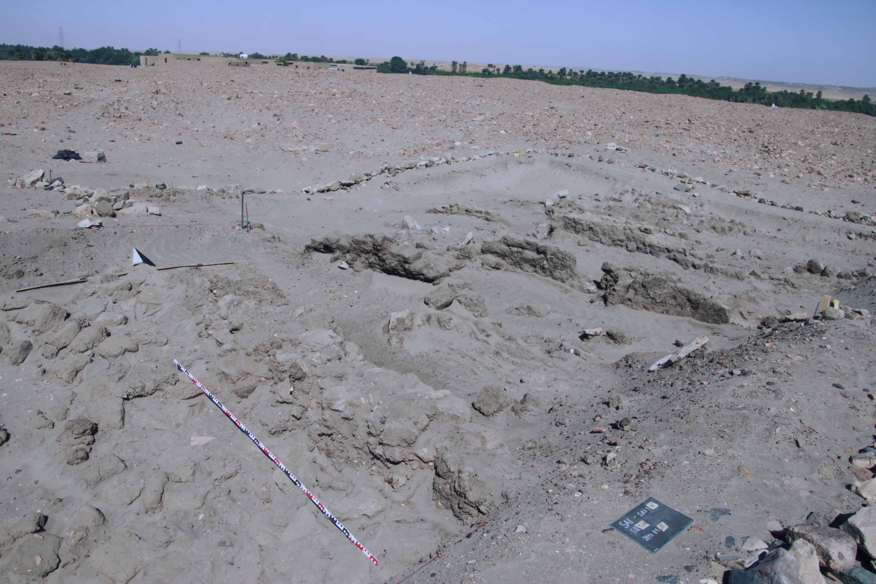
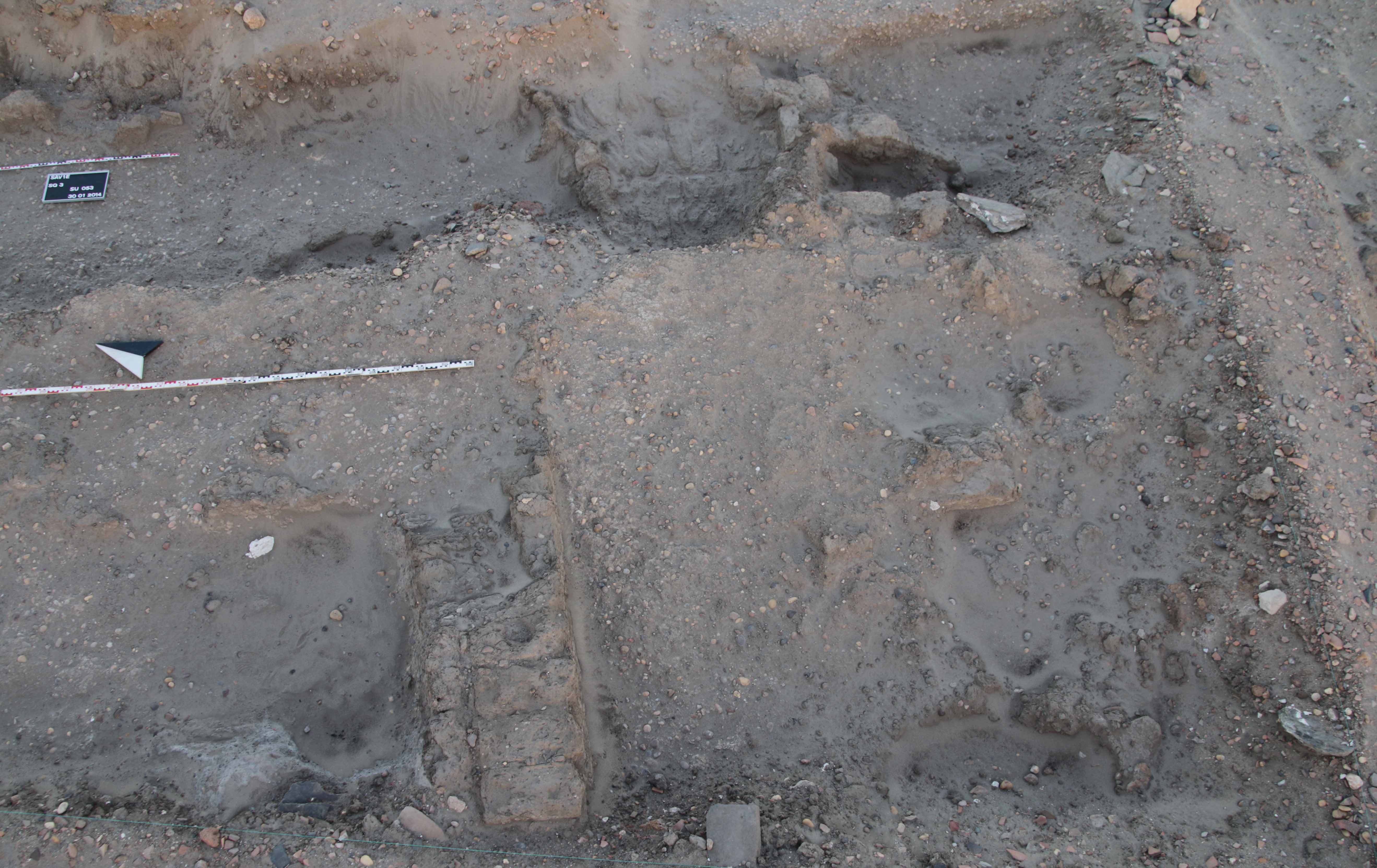
Studying relevant publications it became clear that the evidence of the so often mentioned reoccupation and renovation of the forts in the New Kingdom is rather hard to find. Also the meaning and usage of this obviously exchangeable description of reusing of the forts attracted my attention. It is not in any case clear if the authors really differentiate in general between undertaken renovation in the course of the reoccupation or the restoration of the defensive fortifications (e.g. Emery 1965; Trigger 1976; Adams 1977; Bard, 2007; Heidorn 1999). Of course it makes a difference concerning the nature of the settlement to speak of reoccupied or refortified settlements. Thus I searched intensively in the old excavation reports and publications for any hint of New Kingdom construction activity in the Middle Kingdom forts (like Emery & Kirwan 1935; Steindorff 1937; Randall-MacIver & Woolley 1911; Emery etal. 1979; Dunham & Janssen 1960; Dunham 1967). But unfortunately in most cases there is only little building activity or material post-dating the Middle Kingdom mentioned, because the main focus lies on the primary architecture and remains. Another issue in this respect is in general the dating of the late Middle Kingdom and/orSecond Intermediate Period material: it still remains unclear whether some of the fortresses have been still occupied during the Intermediate Period or not.

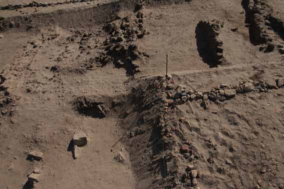
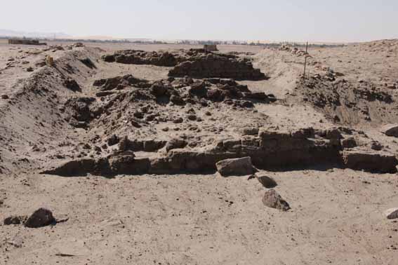
What I can say by now is that serious reconstruction and restoration of the fortifications only took place at Aniba and Buhen, where it is proofed by archaeological evidence. In contrast, because of absence of archaeological evidence, Semna seems not to have been refortified as always stated in the literature (Reisner 1929a; Säve-Söderbergh 1941; Adams 1977; Bard 2007; Heidorn), but indeed reoccupied, attested by the presence of a New Kingdom temple and cemetery (Reisner 1929b; Dunham & Janssen 1960). Another observation I made concerns the fortress of Askut near the Second Cataract. Excavation work was conducted there in the 1960ies by Badawy and the excavated material was reinvestigated by S. T. Smith in the 1990ies (Badawy 1964; Badawy 1968; Smith 1995; Smith 2003). They plausible ascertained a New Kingdom occupation phase at Askut, but still this fortress is often neglected in general studies concerning the New Kingdom occupation phase in Nubia (e.g. Emery 1965; Trigger 1976; Adams 1977; Bard, 2007; Heidorn).

Further and detailed studies are necessary to give an answer to the development-issue of the temple towns and to the dating-issue of the maybe continuously settled or indeed reoccupied fortresses. But the fresh evaluation and reconsideration of the literature shows by now some interesting first results.

Bibliographie

Adams, W. Y. 1977      Nubia. Corridor to Africa, London.

Badawy, A. 1964      Preliminary report on the excavations by the University of California at Askut, Kush 12, 47–56.

Badawy, A. M. 1968      A history of Egyptian Architecture. The Empire (the New Kingdom), Berkely.

Bard, K. A. 2007      An introduction to the archaeology of Ancient Egypt, Malden, Mass.

Dunham, D. 1967      Uronarti, Shalfak, Mirgissa: excavated by George Andrew Reisner and Noel F. Wheeler, Second cataract forts 2, Boston.

Dunham, D. & Janssen, J. J. 1960      Semna, Kumma, Second cataract forts 1, Boston.

Emery, W. B. 1965      Egypt in Nubia, London.

Emery, W. B. & Kirwan, L. P. 1935      The excavations and survey between Wadi es-Sebua and Adindan 1929 – 1931., Mission Archéologique de Nubie 1929 – 1934, Cairo.

Emery, W. B., Smith, H. S. & Millard, A. 1979      Excavations at Buhen. The archaeological report, Excavation memoir 49, London.

Heidorn, L. A. 1999      Nubian towns and temples, 579–583, in: Bard, K. A. & Shubert, S. B. (Hrsg.), Encyclopedia of the archaeology of ancient Egypt, London, New York.

Randall-MacIver, D. & Woolley, L. 1911      Buhen, Eckley B. Coxe Junior expedition to Nubia 7, Philadelphia.

Reisner, G. A. 1929a    Ancient Egyptian forts at Semna and Uronarti, Bulletin of the Museum of Fine Arts 27, 64–75.

Reisner, G. A. 1929b    Excavations at Semna and Uronarti, Sudan notes and records 12.

Säve-Söderbergh, T. 1941      Ägypten und Nubien: ein Beitrag zur Geschichte altägyptischer Aussenpolitik, Lund.

Smith, S. T. 1995      Askut in Nubia. The economics and ideology of Egyptian imperialism in the second millennium B.C, Studies in Egyptology, London, New York.

Smith, S. T. 2003      Wretched Kush. Ethnic identities and boundaries in Egypt’s Nubian empire, London, New York.

Steindorff, G. 1937      Aniba. Mission Archéologique de Nubie 1929 – 1934. 2, Glückstadt.

Trigger, B. 1976      Nubia under the pharaohs, Ancient peoples and places 85, London.

With kith and kin…

Having just read an intriguing article by Stuart Thyson Smith (Smith 2013), I would like to share some thoughts about the inhabitants of Egyptian sites in Nubia during the New Kingdom.

Talking about the range of people typically present in fortresses, Smith rightly states (2013, 269): “Fortress inhabitants usually included both women and children, who are typically neglected in favor of the adult men who performed the more obvious military, political and economic roles associated with these specialized communities.” Data from cemeteries and texts illustrate the presence of women and children in the communities of fortresses and fortified towns. Archaeological evidence from the settlements themselves provides further clues towards understanding the complex composition of the population. Smith presents his careful assessment of the demography, gender and ethnicity at Askut and stresses several aspects of identity issues in archaeology.

Interaction with local peoples is probably attested by the presence of Nubian ceramics at the major Egyptian sites – especially by Nubian cooking ware which could be connected with Nubian women. However, pottery and the coexistence of Egyptian and Nubian types and wares are not straightforward to explain but could reflect various aspects, e.g. a temporary or local fashion or indeed the cultural identity of their users. It becomes even more challenging to find traces of children in the archaeological record. Smith (2013, 274-275) has stressed useful ethnographic parallels and mentions gaming pieces as possible children’s toys and several productive activities like pottery making where children were probably involved.

Very much in line with Smith’s work, AcrossBorders is currently testing the potential of the analysis of material culture to inform for the question of a ‘Nubian’ or ‘Egyptian’ lifestyle within a New Kingdom fortified town like Sai. The identity of the occupants is central to this investigation and must include the complete population which was much more complex and dynamic than just adult men sent from Egypt.

Besides the archaeological finds like pottery and small finds from settlements, a group of inscribed door lintels and door jambs from Egyptian houses provides valuable information. Female persons are mentioned by names and titles on these monuments, indicating their real presence at the specific sites (Budka 2001, 74-75). One door jamb discovered during the 32nd season of the joint mission of the German Archaeological Institute Cairo and the Swiss Institute Cairo at Elephantine is particularly interesting: It belongs to a Ramesside official with the name of Hori (Budka and von Pilgrim 2008). His wife Nofret-irj is mentioned on another door jamb from Elephantine and a seated double statue of the couple is now kept in the Louvre, Paris (A 68).

Statue of Hori & Nofret-irj, Louvre A68.

Statue of Hori & Nofret-irj, Louvre A68.

In this particular case we know, that Hori was coming from Thebes and lived in Elephantine for a certain time span. Common sense tells us that it is unlikely that officials like Hori went to their short-term contracts outside of their hometown without their families: They would have brought already existing wives and children with them. This is also supported by numerous rock inscriptions and stelae in the area of the First Cataract and in Nubia. At Sai Island, a Ramesside door lintel shows a seated couple as house owners; names and titles of wives of officials during the 18th Dynasty are still lacking from this kind of monument but might be unearthed in the future.

In conclusion, besides the very likely fact that Egyptian officials sent to Nubia in the New Kingdom found new partners (including indigenous Nubians) there and started a family in towns like Sai, we should not forget the possibility that men on duty were also accompanied by their already existing family. Individual choices whether an Egyptian wife and children came along on a short-term mission are likely and might become more visible with further work on the complete set of data from settlement sites.

References

Budka 2001 = J. Budka, Der König an der Haustür, Die Rolle des ägyptischen Herrschers an dekorierten Türgewänden von Beamten im Neuen Reich, Vienna 2001.

Budka and von Pilgrim 2008 = J. Budka and B. von Pilgrim 2008. V. Bauteile des Wohnsitzes einer thebanischen Beamtenfamilie in Elephantine, in: G. Dreyer et al., Stadt und Tempel von Elephantine. 33./34./35. Grabungsbericht, Mitteilungen des Deutschen Archäologischen Instituts, Abteilung Kairo 64, 2008, 88–97.

Smith 2013 = St. T. Smith, The Garrison and Inhabitants: A View from Askut, in: F. Jesse and C. Vogel (eds.), The Power of Walls – Fortifications in Ancient Northeastern Africa, Köln 2013, 269–291

Research on the New Kingdom settlement on Sai Island prior to AcrossBorders

Back in the summer of 2012, a joint paper by Florence Doyen and me was submitted to Egypt & Levant (Vienna), focusing on recent excavations on Sai Island within the area of the New Kingdom town.FotoÄ-L22-23

We are very happy that this paper has now been published, being part of a major double-volume of the peer-reviewed journal, covering reports from Tell el-Daba and other Nile delta sites as well as various chronological studies and research concentrating on the archaeology of the Levant.

Our article gives a hopefully useful overview of the history of research on Sai up to 2012, focusing on the recent work by the Sai Island Archaeological Mission (SIAM) of Charles-de-Gaulle – Lille 3 University (UMR 8164 HALMA-IPEL), France.[i] It aims to illustrate the rich potential of the site and its importance for the history of Upper Nubia. The preliminary assessments of the ceramics and architecture from SAV1 North, undertaken in 2011-2012, allow a better understanding of the evolution of the town. As one of the major results of the 2012 SIAM season, the fortified wall in SAV1 North can be dated to the reign of Thutmose III. Until now, there is no enclosure wall attested prior to this king who is well known as being responsible for the heyday of Pharaonic Sai.

SIAM did undertake important steps forward to a closer understanding of Sai Island during the 18th Dynasty – and today, AcrossBorders continues this path with new excavations and detailed assessments, focusing on the material culture and the intriguing mix of life styles at the site.

Full reference of the article:

Julia Budka & Florence Doyen, Living in New Kingdom towns in Upper Nubia – New evidence from recent excavations on Sai Island, Ägypten & Levante 22/23, 2012/2013, 167–208.


[i] Other than stated in the editor’s preface (p. 14-15), the study has nothing to do with my ERC Starting Grant nor the FWF START project – it rather summarizes the status quo from which the new projects were launched.

Looking back on the 3D-Laserscanning Campaign on Sai Island

Even though we have already been back in Vienna for some time, I would like to give some information on the 3D-laserscanning campaign, which was carried out on SAI Island from February 3-10, 2014. Robert Kalasek from the Technical University of Vienna was the main person in charge of the scanning process, providing his know-how and years of practical experience in the field of 3D-laser scanning. My part was to provide technical and scientific assistance, letting the knowledge acquired from last year’s architectural survey flow into the work process.

The main goal of the work was to obtain a complete geometric documentation of the remaining walls and floors of the southern part of the New Kingdom town on Sai Island. 3D-laserscanning seemed to offer the most comprehensive result which could be achieved in a relatively short time.

For the scanning an Image Laser Scanner Riegl VZ-1000 was used, a Nikon D800 camera with a 14 mm lens was mounted on the scanner in order to record the texture. During the scanning process a grid of three dimensional points is automatically measured in the surveyed area by the instrument. So-called 3D point clouds result from this process, including xyz-coordinates and an intensity value depending on the surveyed material.

IMG_1064

Image Laser Scanner Riegl VZ-1000 in front of the ruins

The complete scanning of the remains of the Pharaonic town required 155 different scan positions, whereby the maximum distance of the measured points ranged between 200 and 400 m, according to the angle of incidence and the reflectivity of the material. The result of each scan is a point cloud in a local coordinate system. In a next step, the scans can be joined (registered) with the help of a multitude of reflector points, which were distributed throughout the ruins. Generally, at least five overlapping points are needed in order to put two scans together. These reflector points were also measured with a total station so that the registered scans can be placed into a geo-referenced net. With the help of the intensity information one can encode the three dimensional point clouds with different colors, which is often sufficient to differentiate the various objects.

ansicht_mitte

Scan of part of the storage rooms of the Pharaonic town with different colors for the intensity of the textures

In addition to the standing remains of the Pharaonic town, the newly excavated trenches (SAV1 East and SAV1 West) as well as SAV1 North were also scanned and geo-referenced. In order to collect data for the topographic understanding of the surroundings, four long-range scans (range: 1.2 km) from elevated points were also undertaken. This could maybe help in understanding the general topography of the town and also to clarify questions such as the course of the city wall on the eastern side of the town.

scans_auswahl_aus_allen_projekte_2pt_03_25prozent

Overview of the entire area of the Pharaonic town compiled from selected scans

Looking back on our days on Sai Island, I am happy to say that our campaign proved to be very successful and everything worked out as planned. Luckily, we had very few nimiti-days and the strong winds did not affect the stability of the scans as much as we had feared. The work-flow was very smooth and even though the work load was intense, especially for Robert, who worked on the data acquired during the day every evening until long into the night, we left Sudan with a lot of positive energy.

Next to the final registration of the scans, the post-processing in Vienna now entails the preparation of the data, e.g. reducing the enormous amount of data and refining the registration. The final output, a geometrically accurate three-dimensional model, can be used in the future to produce scaled plans and sections and a terrain model. It can also serve as a basis for further analyses and the creation of a reconstructed visualization of the Pharaonic town.

Pavements and floors at SAV1 East

View of part of the brick pavement in the governor's residence.

View of part of the brick pavement in the governor’s residence.

Different types of floor coatings, layers and pavements are well known from the southern part of the Pharaonic town of Sai examined by Michel Azim in the 1970ties. For example, the central room of the so-called governor’s residence has a splendid and very nicely preserved brick pavement. Some of the magazines show schist floors of which large pieces are still in place, together with a thick layer of gypsum. Similar schist floors have been recently excavated at Amara West, also within the context of storage rooms in the Rameside town.

Magazine with schist floor still in place.

Magazine with schist floor still in place.

At Sai, SAV1 East with its large building complex, Building A, resembles in some aspects the southern part of the town and especially the area of the governor’s residence. During excavation in 2014 a large amount of schist fragments were found (according to our geologist, Erich Draganits, the correct term for this type of stone is amphibolite). Very often these fragments are still coated with gypsum/plaster – direct evidence that they have been used to cover parts of a building, most likely the floor. The schist fragments came to light from both, directly below the modern surface above remains of mud floors and, in larger numbers, from fillings of large pits cutting into the New Kingdom structures. It is therefore likely that a former schist pavement has been destroyed in antiquity and the plates were broken and dislocated.

Overview of Southern half of Square 3 - note the schist fragments in the southern baulk, within the filling of pit 46.

Overview of southern half of Square 3 – note the schist fragments in the southern baulk, within the filling of pit 46.

All in all, 330 fragments were recovered from the western edge of Square 3 and Square 4 at SAV1 East. They would cover an area of approximately 3 square meters (not calculating spaces between the individual plates), indicating that either just a small area of the entrance rooms of Building A was equipped with this special paving or that much has been lost and we only found a very small percentage.

The first interpretation seems more likely as actually 3 square meters fit perfectly to the area where the highest concentration of schist fragments was discovered: between feature 40, a small interior wall running East-West, and feature 36, the main North-South wall in Squares 3 and 4, running parallel to the Eastern side of Building A as exposed in 2013.

    Southwestern corner of Square 3: between features 40, 36 and 46 the highest concentration of schist plates was found (Digital surface model: M. Fera 2014).

Southwestern corner of Square 3: between features 40, 36 and 46 the highest concentration of schist plates was found (Digital surface model: M. Fera 2014).

Some mud pavement remains have also survived – maybe they originally were the lower bedding for the schist plates; towards the south, pit 46 cuts off the New Kingdom remains.

Even if Building A has been badly damaged and its present state of preservation is largely restricted to the foundations, the elaborate schist floor somewhere in the western part of the structure underlines its high quality of building technique and important status comparable to the governor’s residence.

Painter’s pots from SAV1 West

Ancient Egyptian houses have been quite colourful as we know from well preserved sites like Amarna (cf. e.g. Kemp 2012 with nice colour plates and illustrations) and Amara West – in addition to the common mud plaster coating the mud-brick walls, traces of whitewash and painted wall plaster is documented. Also remains of pigments have frequently been found in ancient settlement contexts, most often on some kind of painting palette in various materials.

A small group of 11 pottery vessels from SAV1 West falls into this category and gives first indications that also the houses in the New Kingdom town of Sai might have been partly painted and decorated: these vessels show all traces of pigments on their interior, mostly yellow, blue and some red. These are the most common colours within domestic contexts (as well as for decorating stone blocks of temple architecture).

Interior of one of the painter's pots from SAV1 West.

Interior of one of the painter’s pots from SAV1 West.

The painter’s pots from SAV1 West have all been found in Square 1, towards the east of the enclosure wall, presumably thus connected with structures from the interior of the town. Some grinding stones and hammer stones with traces of pigments have also been noted, as well as plaster remains and what seems to be gypsum.

The vessels are mostly small flat based simple dishes and so-called flower pots – the latter are well known as painter’s pots from tomb context in New Kingdom Egypt (see, e.g. Brack/Brack 1977, 80) and temple sites (for example from the pyramid complex of king Ahmose at South Abydos; personal observation, still unpublished material from Stephen Harvey’s excavation).

One of the "flower pots" from SAV1 West with yellow pigment inside.

One of the “flower pots” from SAV1 West with yellow pigment inside.

Insha’allah we will be able to investigate the pigments, plaster and gypsum left on ceramic sherds and stone tools next year in more detail – possibly with exporting some samples with the permission of the National Corporation for Antiquities & Museums in Sudan for analyses here in Vienna. As yet, the painter’s pots from SAV1 West give small hints that the furnishings in people’s houses of Sai were maybe following similar standards like in Egypt, where light and colour had quite important functions (cf. Kemp 2012, 188-190).

References:

Brack/Brack 1977 = A. Brack and A. Brack, Das Grab des Tjanuni. Theben Nr. 74, AV 19, Mainz am Rhein 1977.

Kemp 2012 = B. J. Kemp, The City of Akhenaten and Nefertiti. Amarna and its people, Cairo 2012.

The New Kingdom town wall at SAV1 West

During the 2014 season we successfully located the 18th Dynasty enclosure wall of the Pharaonic town of Sai in both of our new trenches at SAV1 West. We can hereby confirm the reconstruction of our French colleagues which was based on a surface survey, the general outline of the town and the location of the Western city gate.

The western edge of the Pharaonic town of Sai: looking across the Western city gate towards the new squares.

The western edge of the Pharaonic town of Sai: looking across the Western city gate towards the new squares in the North. To the right, the Northwestern tower of the Ottoman fortress, built above Pharaonic remains, is visible.

We were also able to identify some later additions and Post-Pharaonic construction work in our new trenches. During excavations, it was not very clear whether the later wall in Square 1W was located above a bastion and if the “front wall” we found could be of New Kingdom date after all.

SAI_6467Both questions have been answered in the meantime: There is no tower attached to the enclosure wall in the area of Square 1, and the “front wall” post-dates clearly the 18th Dynasty city wall. The situation in trench 2 seems to be very similar – the outline of the 18th Dynasty wall is now understandable, despite of the deep Post-New Kingdom pits within the brickwork, and it corresponds nicely to the presumed line drawn from the Western city gate towards the North.

Among the most important results of this season is the discovery of floor levels and occupation deposits on the inner side of the enclosure wall, both at Square 1 and trench 2 – all was covered by sand and mixed debris, but now there are really remains waiting for us which seem to be undisturbed! There are several floor levels visible, having been cut by the later pits – suggesting subsequent phases of Pharaonic presence at the site. Thus, SAV1 West will potentially add a lot of information about the inner structure, evolution and layout of the town – and will keep us busy in the next years.

The enclosure wall in Square 1 - almost completly destroyed in the northern part, damaged in the southern area but note the promising deposits towards the East.

The enclosure wall in Square 1 – almost completly destroyed in the northern part, damaged in the southern area but note the promising deposits towards the East.

End of week 4 of fieldwork at Sai Island, New Kingdom Town

During this week, we made good progress at both sites currently under investigation of the Pharaonic town of Sai, at SAV1 West and SAV1 East.

SAI_7663a

Work in progress at SAV1 West, 30/01/2014.

The brick work at SAV1 West was cleaned of the loose debris – we now have the substantial remains of the New Kingdom fortification exposed. The subsidiary, secondary adjacent wall was also found as proceeding further towards the North – as was the so-called “front wall”. Of the latter, we just cleaned today debris towards the west – the dismantled mud bricks are presumably lying on the natural slope of the western edge of the town; giving us much hope that we will be able to clarify its date and phases of use in the upcoming week!

Overview of SAV1 West; view towards Northeast. Debris at top of western slope in foreground.

Overview of SAV1 West; view towards Northeast. Debris at top of western slope in foreground.

I am especially excited about work at SAV1 East – we were aiming to clarify the western extension of our Building A, a possible large administrative building of Thutmoside date.

Cleaning of western part of Square 3, SAV1 East,

Cleaning of western part of Square 3, SAV1 East.

In the last days, Jördis worked with her team in the very difficult deposit of Square 3: within backfilling of late pits and disturbances, they were able to trace the foundations of a very large mud brick wall! Its alignment matches our East wall of Building A’s courtyard – and it is in line with the main North-South street of the town, running from the Southern gate, the Governor’s residence and Temple A towards our area SAV1 East.

Foundations of substantial mud brick wall at SAV1 East.

Foundations of substantial mud brick wall at SAV1 East.

Despite the pitting, we do have traces of the floor levels preserved and some smaller East-West walls, possibly of entrance rooms similar to the ones in the Governor’s residence SAF2. The challenge will be to reconstruct the complete outline of our building from these largely destroyed and dismanteled remains!

Overview of western part of Square 3, 30/01/2014: the main North-South wall, remains of pavements and a smaller East-West wall

Overview of western part of Square 3, 30/01/2014: the main North-South wall, remains of pavements and a smaller East-West wall.

As yet, both the New Kingdom ceramics from SAV1 West and SAV1 East associated with our mud brick structures do not predate the reign of Thutmose III – stressing that we are currently working in areas which belong to the main building phase of the Upper Nubian temple town at Sai which flourished during the time of Thutmose III and Amenhotep II.

An Update: The Enclosure Wall at SAV1 West

It is a well-established fact that the Pharaonic town of Sai with its fortified town, temple and administrative buildings falls into the category of so-called Egyptian “temple towns”, built during the New Kingdom in Nubia. The substantial mud brick enclosure wall of Sai with a width of more than 4.20 m has been investigated by the late Michel Azim (Azim 1975) in the South and Florence Doyen in the North (cf. Doyen 2009). As was confirmed in both sectors, the wall is equipped with bastions in regular distances. Our current work at SAV1 West aims to deepen the understanding of the layout, outline and construction of the enclosure wall as well as its building phases and periods of destruction.

At the moment – and this is all work in progress! – we were able to expose the outline of the western enclosure wall in the trenches 1 and 2. Its location fits perfectly to what Azim reconstructed as the western border of the Pharaonic town. However, there are still a lot of open questions – especially because of later disturbances and pits, but also due to several building phases within the brick work. In trench 2 we might have encountered a late sub-circular structure of possible Ottoman date, set into the 18th Dynasty enclosure wall. We will try to clarify this next week.

Western half of Square 1 (left) and Square 1W (right) at SAV1 West - overview towards South (Photo: Martin Fera).

Western half of Square 1 (left) and Square 1W (right) at SAV1 West – overview towards South (Photo: Martin Fera).

In the southwestern corner of Square 1, the upper part of the enclosure wall as we exposed it so far is still covered with debris; a large pit filled with mostly Christian pottery was cutting into this area. Similar holes have been dug into the brick work of the enclosure wall at SAV1 North (see Doyen 2009). As was already observed by Azim in the 1970s, the Sai New Kingdom fortification suffered from several destructions, but also restoration phases during its use-life (Azim 1975, 122). A good example of a restoration is the tower construction N2 at SAV1 North which is maybe of Ramesside date (Doyen 2009).

View of the enclosure wall at SAV1West in the front; the other brick walls in the back (looking West).

View of the enclosure wall at SAV1West in the front; other brick walls in the back (looking West).

A later addition to the western outline of the 18th Dynasty wall is now also traceable with our extension towards the west, Square 1W. Within this trench we also located a possible “front wall”, of which we as yet only reached the upper part. It seems as if a secondary construction was set between the New Kingdom brick work – spanning the area from the presumed front wall and the enclosure wall. A layer holding much organic material, charcoal and pottery of a domestic character may indicate that we have found here a small occupation spot, maybe a modest hut or shelter. Its date remains to be established but the pottery points to a Late Christian origin. However, it is intriguing that we also have some Ramesside sherds coming from Square 1W and the western half of Square 1 – comparing nicely to the findings around the tower at SAV1 North. At present, we cannot rule out that our squares are set above one of the bastions of the enclosure wall, maybe following complex building phases – all of this remains to be investigated during the upcoming three weeks of fieldwork at SAV1 West.

References:

Azim 1975 = M. Azim, Quatre campagnes de fouilles sur la Forteresse de Saï, 1970-1973. 1ère partie: l’installation pharaonique, CRIPEL  3, 1975, 1–125.

Doyen 2009 = F. Doyen, The New Kingdom Town on Sai Island (Northern Sudan), Sudan & Nubia 13, 2009, 17–20.