New thoughts on Building A

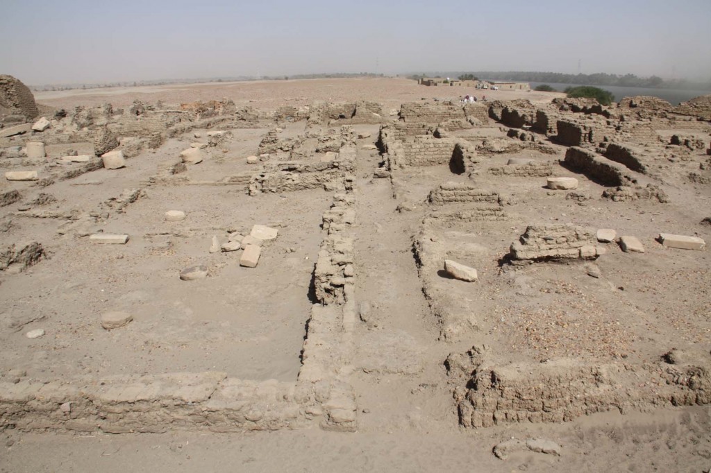
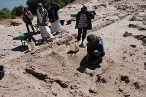
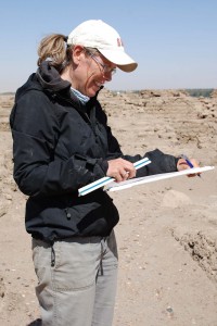
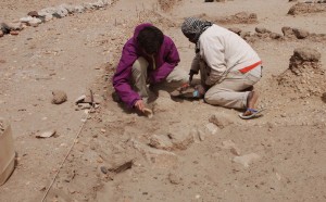
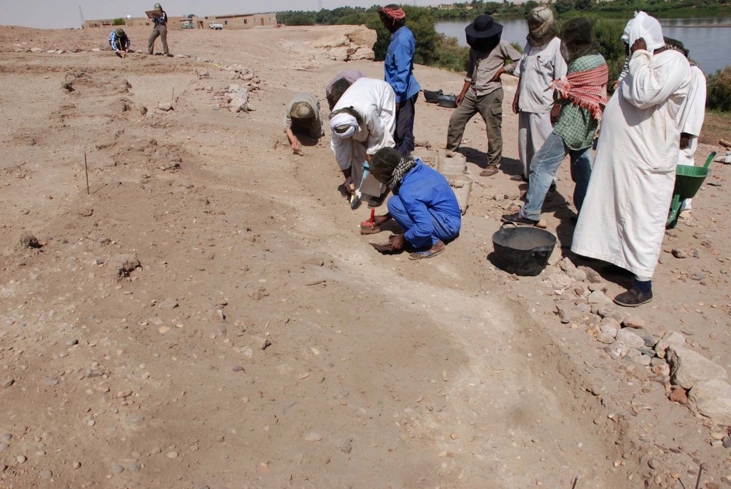
Back in Vienna, processing the data from the field season is keeping us busy. The most important discovery of 2013, Building A is of course still one of the focal points. In general, the new work in area SAV1 East has produced further evidence that the New Kingdom town on Sai experienced its heyday during the reign of Thutmose III and added important knowledge concerning the general layout of the town.

Despite of its fragmentary state, a tentative reconstruction of Building A is possible. Please note that this is a first assessment, any comments are very welcome!

Building A reconstruction small

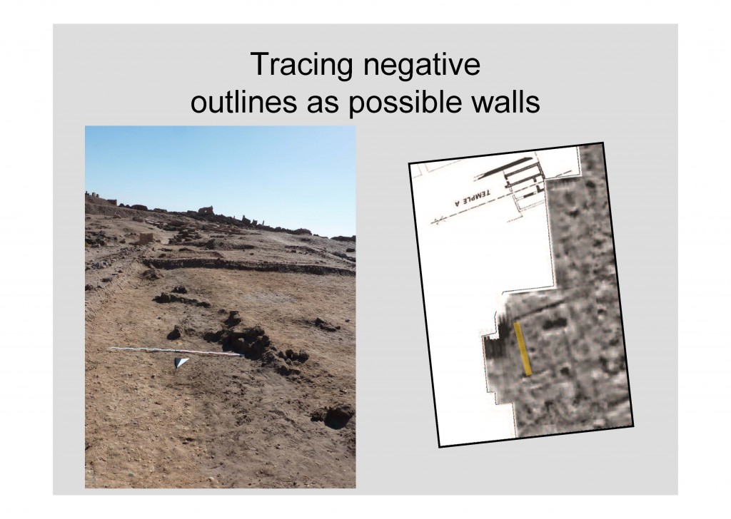
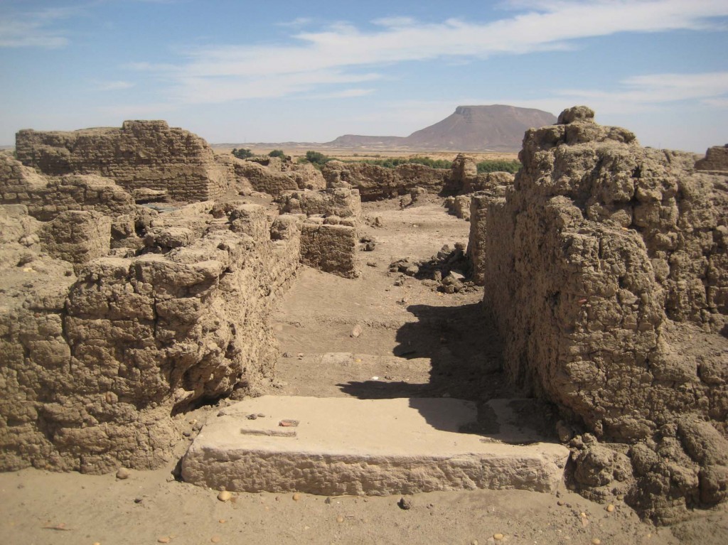
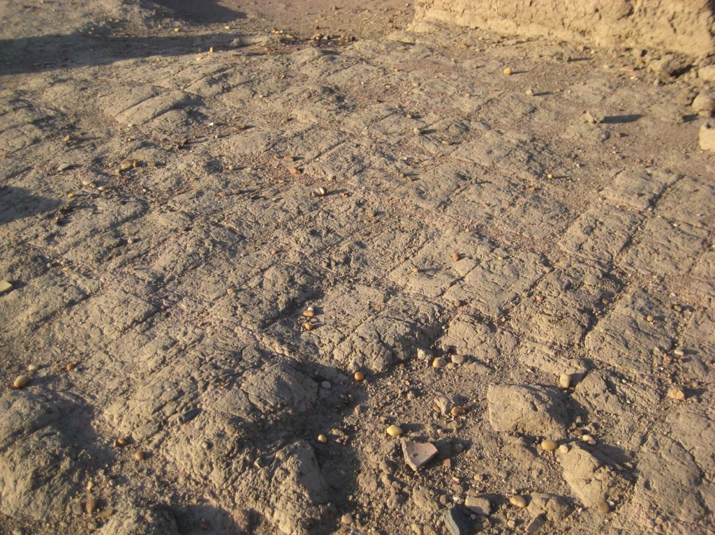
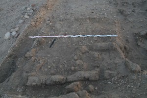
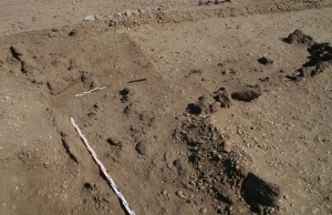
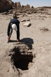
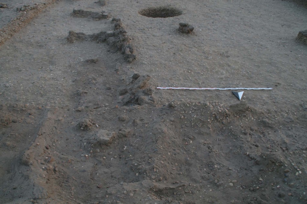
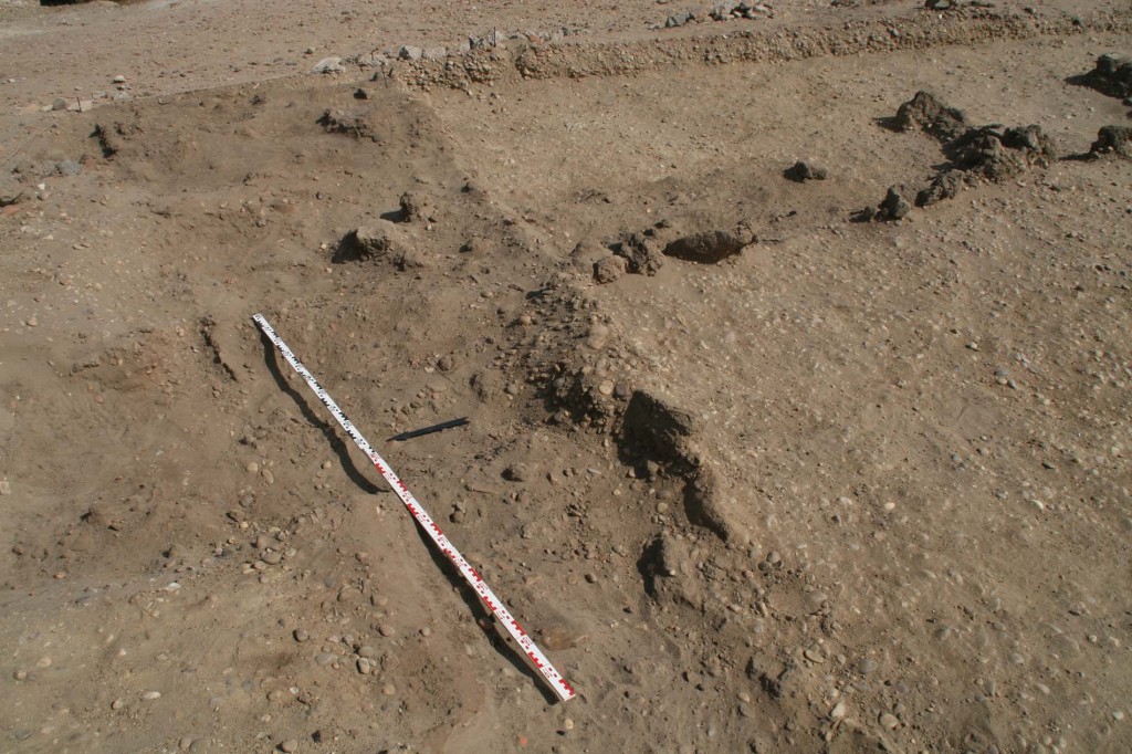
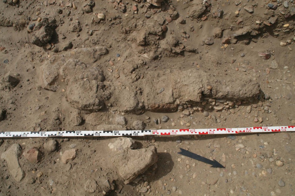
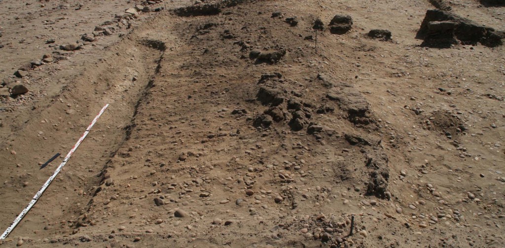
Our “North”, “East” and “South” walls clearly frame a central part of the complex, but are not the outer enclosures or outer walls. This became clear as we unearthed an area covered by a floor north of wall 21 in Square 1a. This floor (marked as hatched area on the sketch above) was partly cut by later pits filled with dump material, but it is clearly contemporaneous to Building A. So we have a paved area towards our northern limits of excavations. The “Northern” wall running East-West has an obvious corner in the Northwest part of Square 1 – we might interpret this as an entrance situation, a possible doorway into a large courtyard, occupying most of Square 1 and extending into Square 2. Within this courtyard there were several pits, of which feature 6 was the most substantial circular storage installation. Towards the east, this courtyard is flanked by wall 3. This wall allows calculating the North-South extension of this part of Building A as 16.3 m; the East-West extension of the courtyard is still not fully exposed, but was traced as up to 10 m until the baulk of Square 2.

As was posted earlier, Building A finds a very close parallel in the so-called governor’s residence SAF2 in the Southern part of the New Kingdom town. The central part of this building is not a courtyard but a large columned hall with a mud brick pavement. The eastern extension of SAF2 can be compared to our traces of a mud brick wall in the Northeastern corner of SAV1 E – broken off towards the East due to the sloping ground, it is very likely that there was once a kind of annex alongside the courtyard.

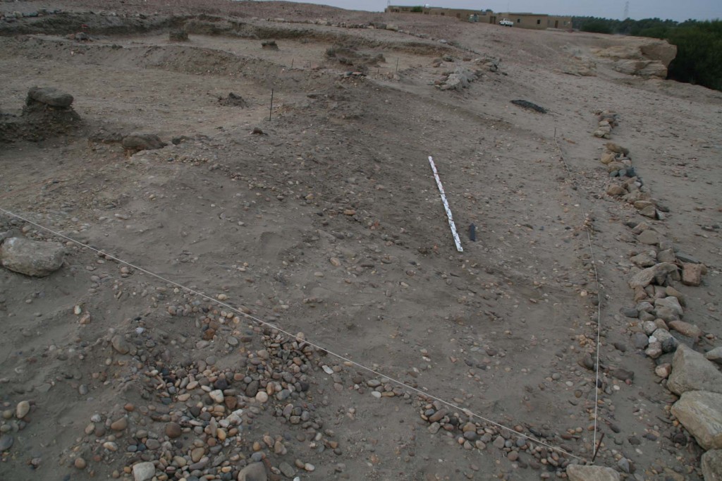
Furthermore, and in analogy with SAF2, one might expect a series of small entrance rooms in the western part of Building A which is still not yet excavated. This will be investigated by means of excavations in 2014!

The functional interpretation of Building A must stay open for the moment, but we might have unearthed another administrative building within the Pharaonic town of Sai, with possible links to Temple A and/or SAF2. It is striking that we could date Building A as contemporaneous to these major buildings in the Southern part of the town which all share a common East-West-alignment along a North-South axis, thus following the typical grid pattern of fortified New Kingdom town in Nubia.

All in all, our newly discovered complex at SAV1E seems to support the important role of Sai within the Egyptian administration in Upper Nubia during the 18th Dynasty.

A Brief Summary of the 2013 field season

After 10 weeks in Sudan, it feels very strange to get ready for leaving in a few days! Today I had to pack everything up at the Museum and to say goodbye to all of the kind and helpful colleagues of NCAM and the French Unit.

Having spent the last days with preparing the lecture and writing the report, many new ideas and thoughts have crossed my mind and I am very eager to continue the post-excavation processing of SAV1 East! We really made some significant discoveries this season – for now, I will just give a brief overview focusing on the most important results.

The key discovery at the new excavation site SAV1E and the highlight of the 2013 season on Sai Island was of course the confirmation of the geophysical survey picture: we were able to trace the eastern part of a very large rectangular mud brick structure (North-South extension of 16.3 + x m; East-West 10 + x m) which we labelled Building A.

Budka 12-03-2013 KHRT Lecture folie 31

Most of the bricks from its walls have been taken out and are now just “phantom walls” represented by a sandy pit, but we found large sections of the foundation trench and also an area with a floor coating towards the North. Associated finds and especially potteryallowed us to date Building A to the mid 18th Dynasty (see below). Its western part still remains to be excavated – the prime task for next season!

All in all, the new fieldwork conducted in 2013 at SAV1E adds important aspects to the understanding of the development and history of the Pharaonic Town of Sai Island:

(1)   The earliest remains at SAV1E are dating to the early 18th Dynasty; there is nothing of the Kerma period prior to the New Kingdom. The area can therefore be safely interpreted as part of the newly founded Egyptian town. The Kerma ceramics we found are clearly originating from early New Kingdom contexts as in SAV1 North.

(2)   The southern part of SAV1E with remains like the storage bin (feature 14) can be linked with the domestic zone excavated around Temple A by M. Azim – this area is characterized by small structures with single-brick walls and storage facilities. It is an early occupation phase comparable to Level 4 at SAV1N and clearly of pre-Thutmose III date. The in situ vessels of storage bin 14 give a more precise dating as early 18th Dynasty, possibly Ahmose-Thutmose I.

(3)   The northern part of SAV1E yielded so-called Building A – a not yet fully exposed mud brick structure with an orthogonal layout and most importantly with striking parallels to the so-called residence SAF2 in the Southern part of the Pharaonic Town. We really cannot wait to excavate the western part of Building A in order to confirm this hypothesis! As we have been fortunate to discover pottery in the foundation trench, we have a good dating indication of the building date of Building A: the pot sherds give us a terminus ante quem non for the setting of the foundations and this is the time of Thutmose III! This all suggests that Building A belongs to the major remodelling of the New Kingdom Town of Sai during the reign of this king. The newly discovered structure does also fit nicely into the grid-pattern of the Southern part of the town with roughly north-south and east-west aligned streets and it is most likely contemporaneous with Temple A and the mud brick enclosure wall.

View above Temple A to SAV1E at the end of fieldwork in 2013

View above Temple A to SAV1E at the end of fieldwork in 2013

Summing up, the first field season of AcrossBorders in 2013 was very successful and will allow us making very specific plans for the upcoming seasons!

More Observations from the Architectural Survey

The architectural survey of the southern part of town proved to be very successful and many new observations could be made as well as old ones verified. Back in Vienna, the sketches and measurements taken on Sai will be integrated into a new map of the New Kingdom town and the written observations will be compiled into a so-called room book.

H1_5_Korridor von Süd

Overview of the residential buildings showing the grid-like pattern

Overall it can be said that the buildings in this part of the Pharaonic settlement were apparently well planned and executed. The walls are throughout perpendicular to each other, forming rectangular rooms and a strict grid of houses and streets.

SAF2_Bautechnik

Detail of the brick-laying technique

The building technique of the walls is very homogeneous as well: basically, only two brick formats were used, larger ones with 40x19x9cm at the so-called palatial building and smaller ones with 33x17x8cm elsewhere.The applied brickwork also always follows a similar pattern. One course of bricks consists of facing stretchers followed by a number of headers according to the thickness of the respective wall. In the alternating course, the stretchers were placed on the other side of the wall. Large gaps were left between the bricks, which could be up to 10cm wide. The thickness of the walls varies from about 54cm to 106cm, whereby one can assume that the houses with thicker walls had a second storey.

Of special note is the large residential building in the eastern part of the town. Apart from its considerable size, the execution of the brickwork and the building details sets it apart from the other dwelling units. The building had a central hall with six columns – two of the column bases are still in situ – and floors in the main rooms made of brick which were laid into a special pattern. The finely cut sandstone thresholds are further proof of the high standard of this residence.

SAF2_Raum 3 von West

Entrance into the so-called palatial building

Raum9_Boden

Brick floor of the palatial building

The foundations of walls of Building A

Today, apart from documenting ceramics in the lab and some mapping in the field, we focused on the North-eastern corner of Building A. As reported, we have a Northern wall running almost East-West, extending beyond the eastern wall towards the Nile. Unfortunately the corner between these two walls is heavily disturbed by a later pit, probably dug in Medieval or Ottoman times. Most of the bricks are lost or broken off; only a few have remained in place. Some of the mud plaster has survived as well – between bricks, but also with negative impressions of now lost mud bricks – thus allowing us to reconstruct part of the masonry. All in all, we are therefore able to trace the alignment of the wall. The northern wall is only 75 cm wide, whereas the eastern wall is more solid with a thickness of 106 cm, thus fitting nicely to a measurement of two Egyptian cubits.

To check the alignment and the junction between the walls, we partly exposed the IMG_4817foundation trench of the northern wall. It is well visible both from above and in the section – on both sides of the wall a quite narrow pit, filled with loose gravels and some large mud bricks. Very unexpectedly, two diagnostic pottery sherds were found in this otherwise findless foundation: both seem to give a very good dating indication for Building A at last! At the first glance, both are mid 18th Dynasty in date and a painted rim sherd, shown here in its original find location south of wall 30, will be very indicative as it can most probably be tied down to Thutmose III or Amenhotep II. IMG_4806

Thus, a dating of our major New Kingdom structure at SAV1E to the reign of Thutmose III becomes more and more likely, confirming our thoughts about the development of the Pharaonic Town of Sai so far!

Evaluating the Northeast corner of Building A

Approaching the end of our fieldwork, we are currently focusing on measuring DSC_5404and mapping the excavated northern part of Building A. As stated earlier, on its eastern side and here at its north-eastern corner, the northern wall running East-West continues towards the Nile.

We have by now removed part of the debris covering this area, comprising of decayed mud bricks, mud mixed with plant remains and very diverse pot sherds, mostly of the Christian and IMG_3777Ottoman period. The complete thickness of the wall is visible, with several bricks still in place, confirming our negative evidence of the robbed wall trench further to the West. At least two layers are preserved and a third layer is partly recognisable. Cleaning of the Northeast corner is time-consuming and not yet finished – assessing the Northeast corner of Building A is thus still on-going and will continue tomorrow.  IMG_3704

A Brief Update on the Architectural Survey

DSC_5173The architectural survey and the reexamination of the southern part of the Pharaonic town of Sai Island continues as planned. Its current focus lies on the eastern part of the area with a prominent large structure, the so-called palatial building featuring a large hall with columns. Floor DSC_5193levels and pavements are partly well preserved and the zone is very interesting, but also highly complex.

Making detailed sketches and taking measurements of structures, walls and mud bricksDSC_5184 are the main daily working tasks of our architect Ingrid Adenstedt in order to reassess the town plan.


Some Answers & New Questions at SAV1E

IMG_0054

Northeast corner of Building A, looking towards the South

After five weeks of fieldwork, we are happy to confirm the extension of our Eastern wall of Building A: just as it was visible on the geophysical survey map, we located the Northern end of this wall and its Northeast corner in our extension to Square 1. The distance from this corner to its Southern counterpart is a little less than 16 meters. Similar as in the Southern part, we were only able to trace the final layer of bricks in fragments, most of the Northern wall running East-West is now just a negative, filled with sand and some debris.As encouraging as these results are, they are of course also raising new questions: (1) the Northern wall seems to continue towards the East – at least 3 bricks are perfectly in line and still in place, situated to the East of the Eastern wall; more bricks are visible further to the East, still covered by a thick layer of mud. Probably the wall was thus running further towards the Nile. (2) A nice mud floor covers the area just north of the newly located Northern wall of Building A and seems to be associated with it.

IMG_2958

View of the Northern wall of Building A, featuring an extension towards the East (looking Southeast)

All in all, Building A seems to be more complex as originally thought. We probably have one large courtyard with the substantial walls we labelled so far as Eastern, Southern and Northern walls, comprising the storage pits mentioned earlier like pit 6. Towards the west, there might have been at least one North-South divider after roughly 5 meters, of which we have only a few bricks left.

We will focus in the upcoming week on this still puzzling Northern area of our main structure at SAV1E which we can firmly date to the 18th Dynasty.IMG_0080

More Bricks at SAV1E

Work focused at the end of week 5 on the southern extension of Square 2. The surface in this area was scattered with numerous pot sherds and a lot of stone fDSC_4573ragments. Among the main reasons for extending the limits of our square was feature 20 in the south-western corner of Square 2: two mud bricks in line, obviously continuing towards the South. The alignment is similar to feature 18 and we wanted to get more information about its preserved size and if possible some stratigraphic information.

Within the southern extension we uncovered another two, fragmented bricks belonging to feature 20. On both sides of it several stone fragments came up and especially the southern end of the structure is heavily disturbed respectively lost. feature 20

All in all, the area is characterised by broken bricks, pottery sherds of mixed date and a lot of stone chips and gravels. It looks as if the natural grounds slopes towards the South and we found a large dump deposit, filling a natural depression to the South of SAV1E. Work will continue here in the upcoming week.


Brushing bricks of Building A

The little of what is left from the eastern wall of Building A required very careful cleaning, especially in its highly damaged South-eastern corner. Situated on a sloping area, we worked today in the eastern extension of Square 2 and were able to make the general outline of the wall visible.DSC_4347Most of the bricks on a gravel deposit are almost faded and the material is generally very fragile – having been disturbed in ancient and medieval times. Nevertheless, a lot of 18th Dynasty pottery is associated with this section of mud bricks, again primarily comprising of bread moulds and beer jars.

Square 2a 0502Together with some bricks still in place in the northern extension to Square 1 (= the North-eastern corner), we will be able to measure the North-South extension of Building A exactly. Detailed mapping will continue tomorrow, for now a length of roughly 16 meters confirms the plan visible on the geophysical survey map from 2011.

Uncovering More of Building A

Starting into week 4 of our fieldwork, we made an extension to the east of Square 2 in order to reveal more of the Eastern wall of Building A. Already just a few centimetres below the surface we found collapsed mud bricks, together with a quite large number of pottery. The ceramics are again predominantly of 18th Dynasty date (60 % versus 40 % of Post-New Kingdom material). Like at the beginning of our work at SAV1E, the corpus mainly comprises bread moulds and beer jars.

Because of the sloping ground at this eastern edge of our excavation area, we have to proceed very carefully and thus slowly. But at the end of the day, the extension of the wall is clearly visible – not yet in clear outline or with bricks in place, but as depression filled with broken mud bricks and sandy material.

IMG_0643