Palaces in New Kingdom temple towns?

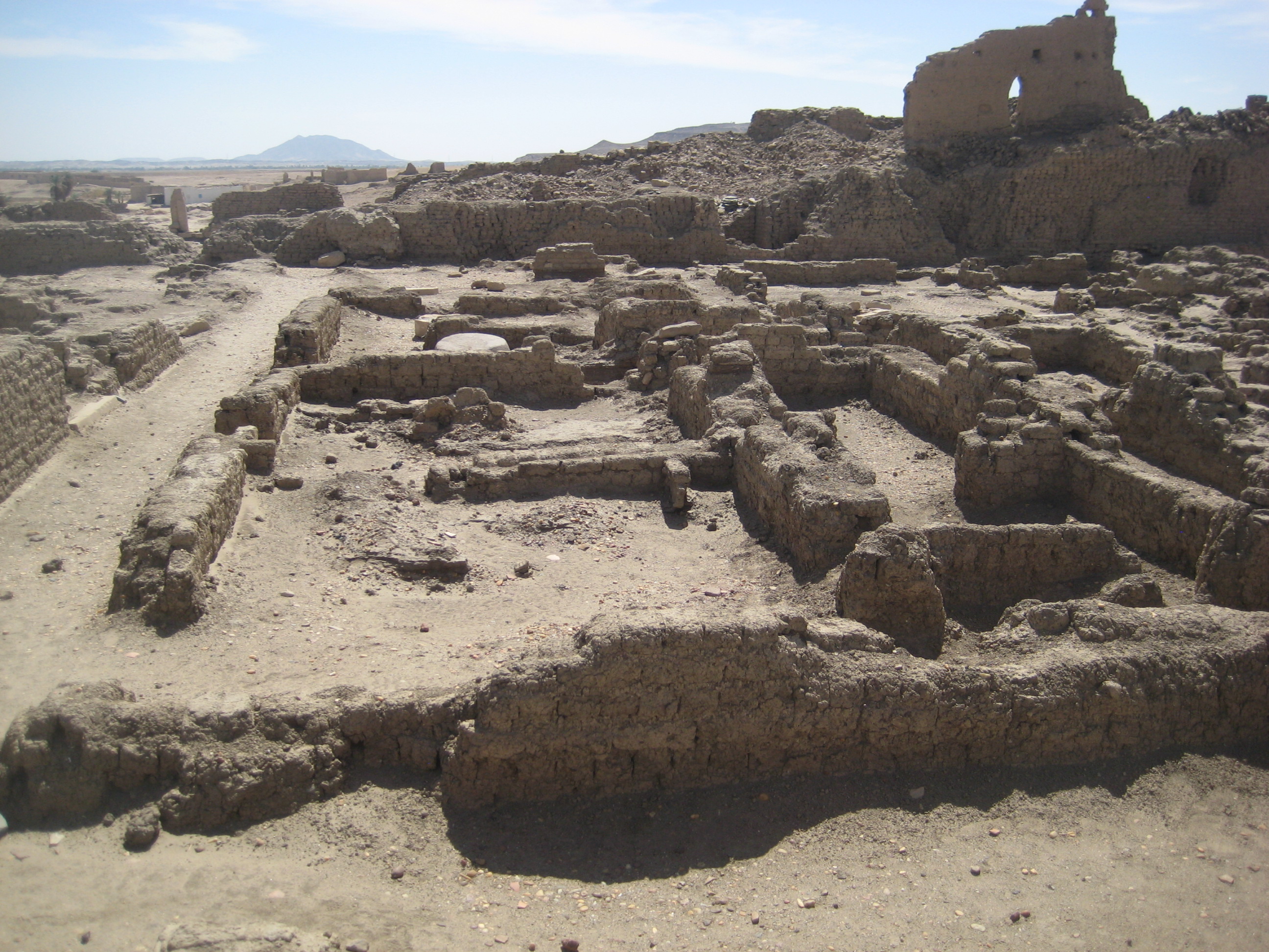
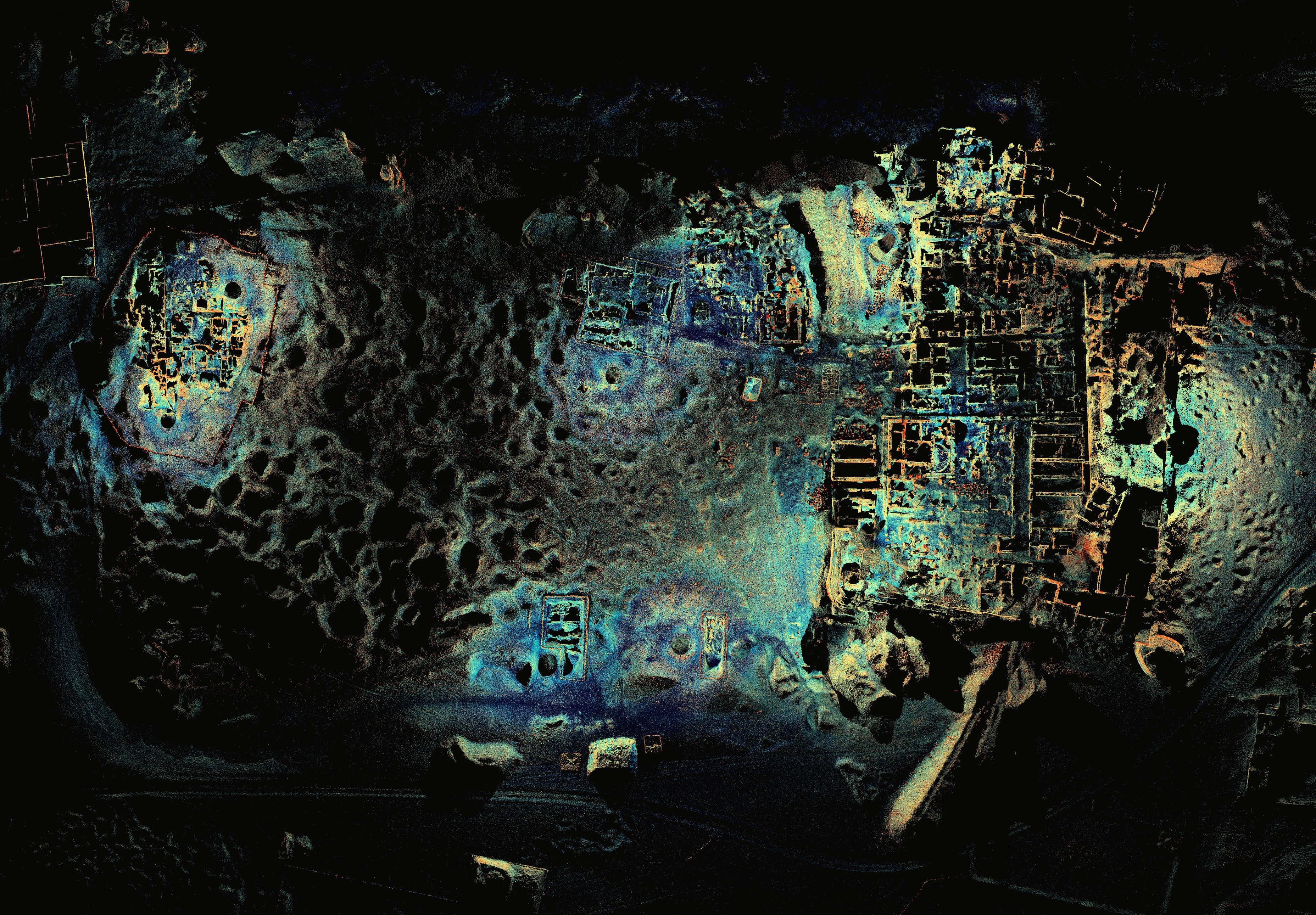
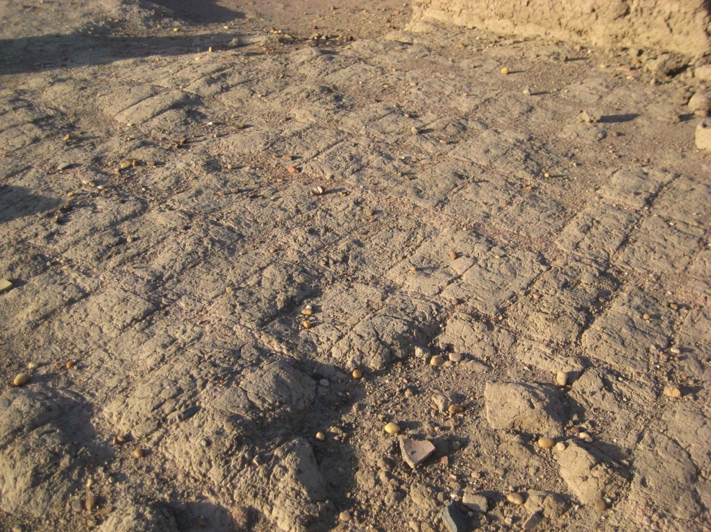
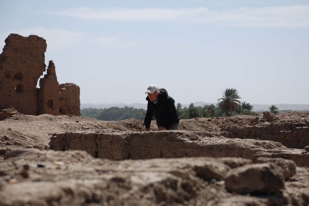
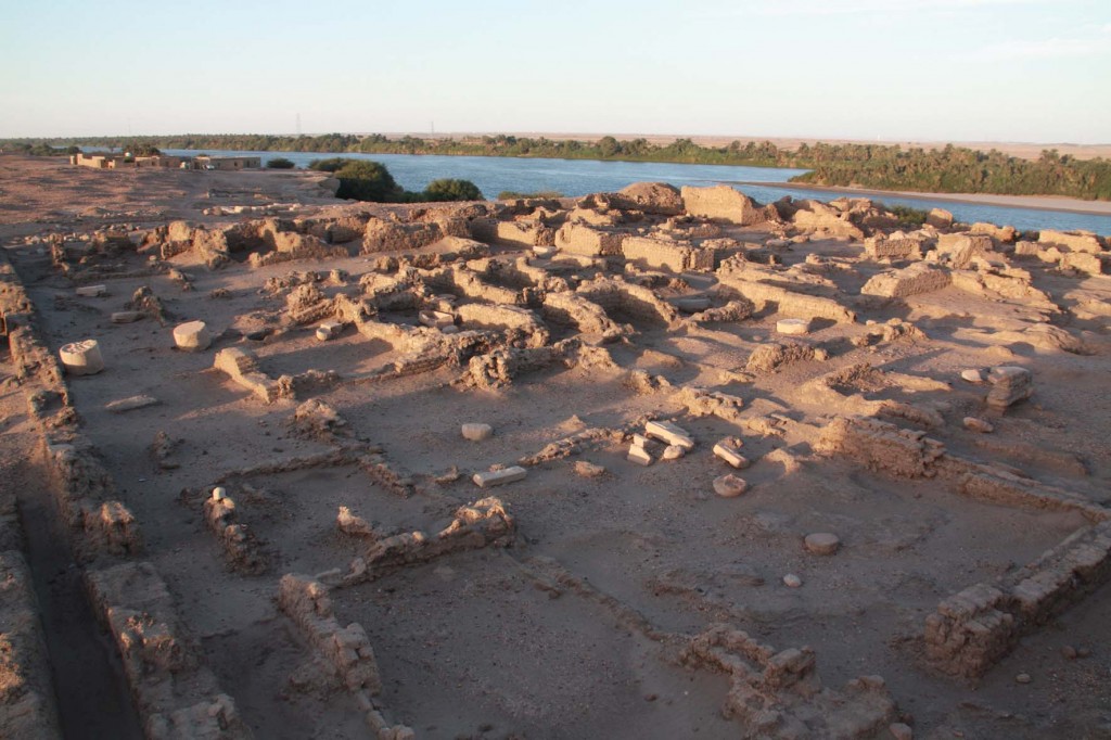
One of the characteristics of the so-called temple towns in Nubia is the presence of so-called governor’s palaces in the south-eastern corner of the walled area. These exceptional, palace-like houses are situated in the vicinity of the stone temples of the individual towns and most probably functioned as headquarter for the local ruler or highest official. In an article recently published, I presented some thoughts based on the evidence from Sai and the so-called palace SAF2, including AcrossBorders’ new results from sector SAV1 East (Budka 2018).

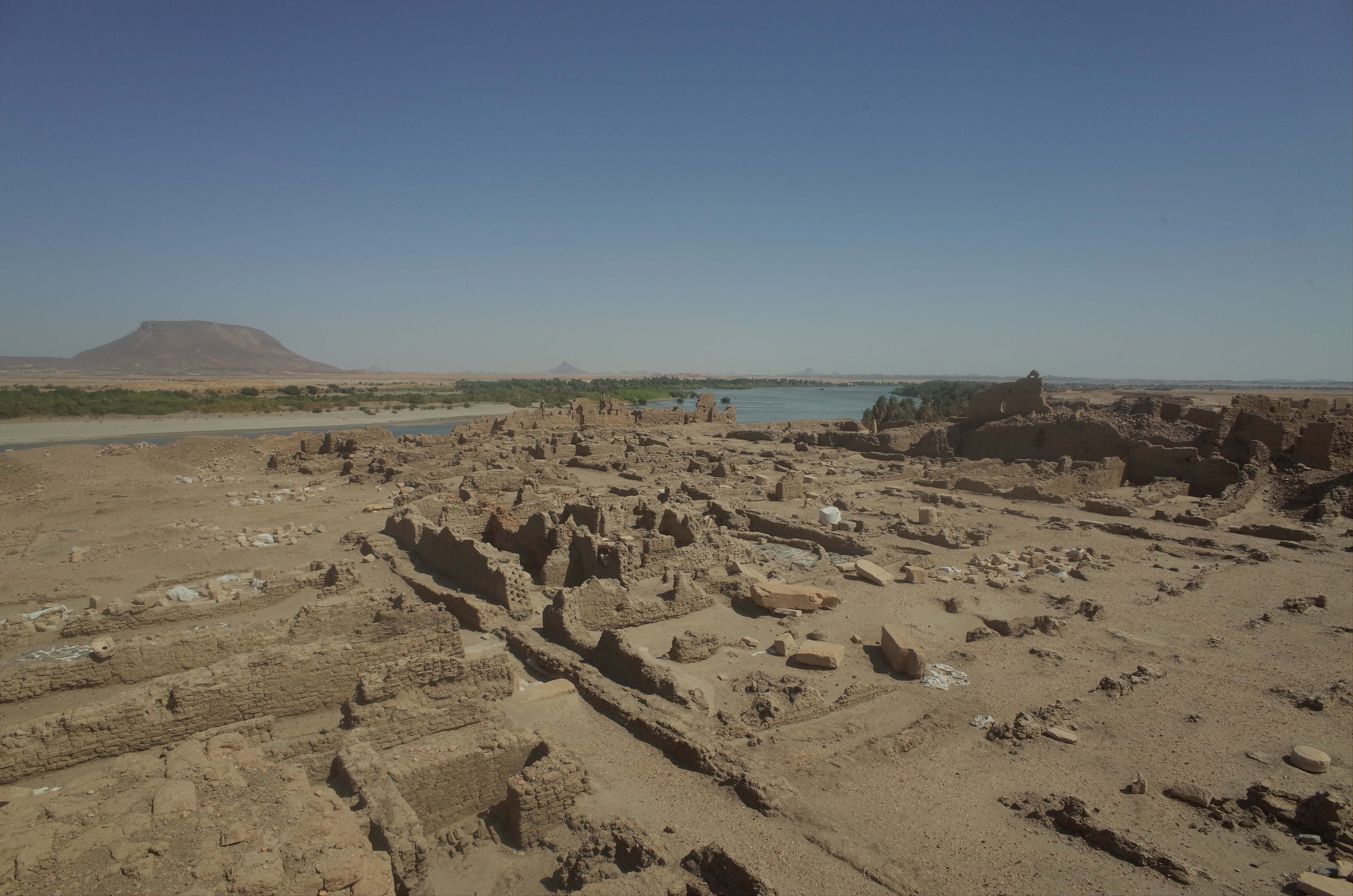
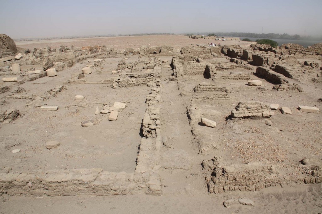
Overview of southern part of the New Kingdom town of Sai, with so-called palace in the background (southeastern corner of town).

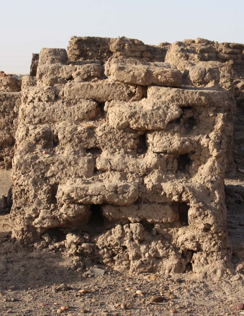
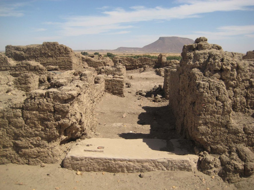
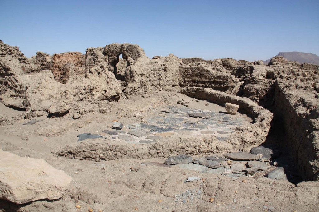
I tried to argue that the close relationship of the “palace” and the stone temple for gods becomes very evident on Sai. Obviously, SAF2 was a representative building for the local administration and offi cials like the mayor and the jdnw of Kush. Small details like the non-axial access to the main columned hall and storage installations indicate that in addition to its evocative character as an “Egyptian” building, SAF2 was really used for domestic purposes.

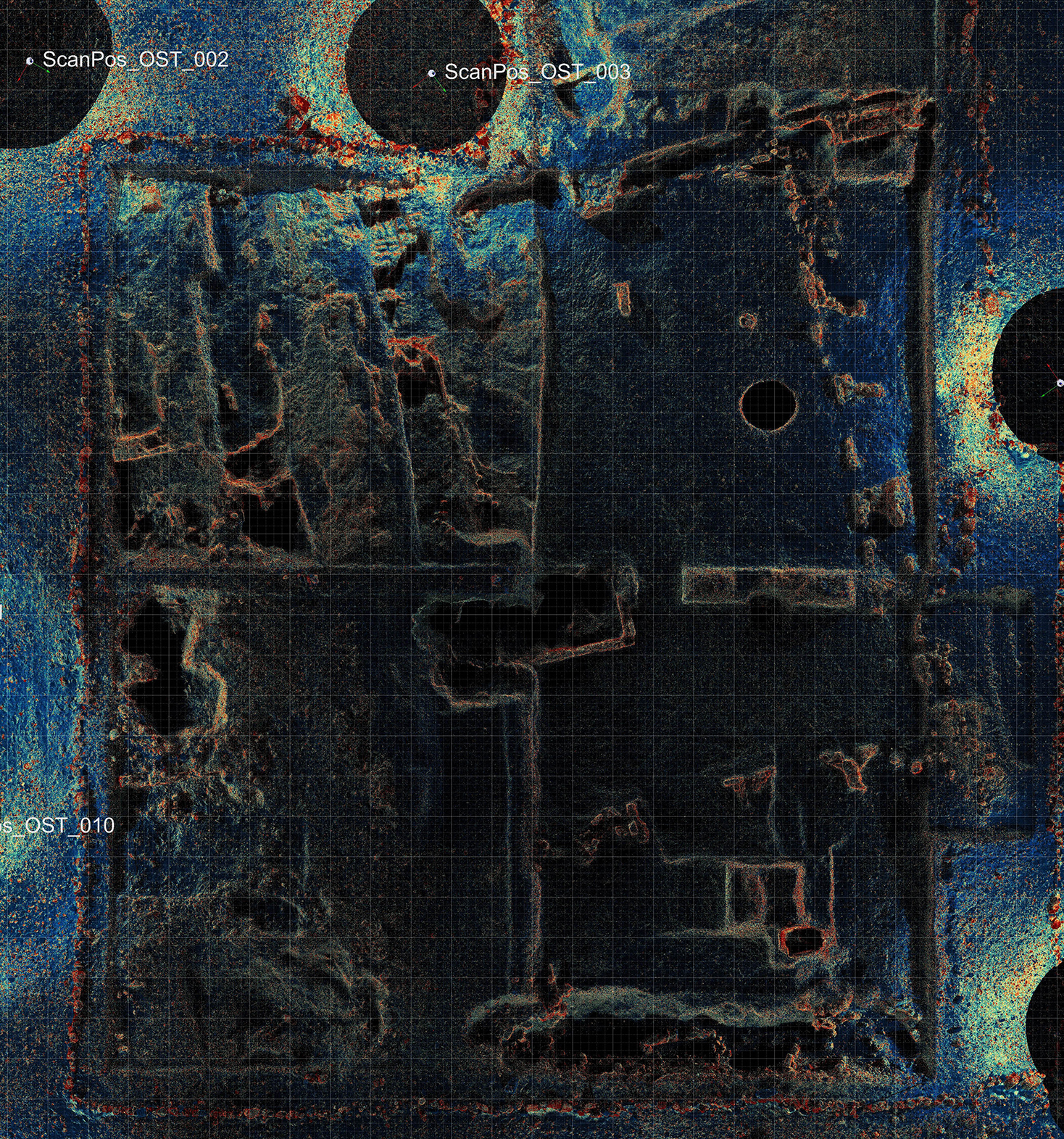
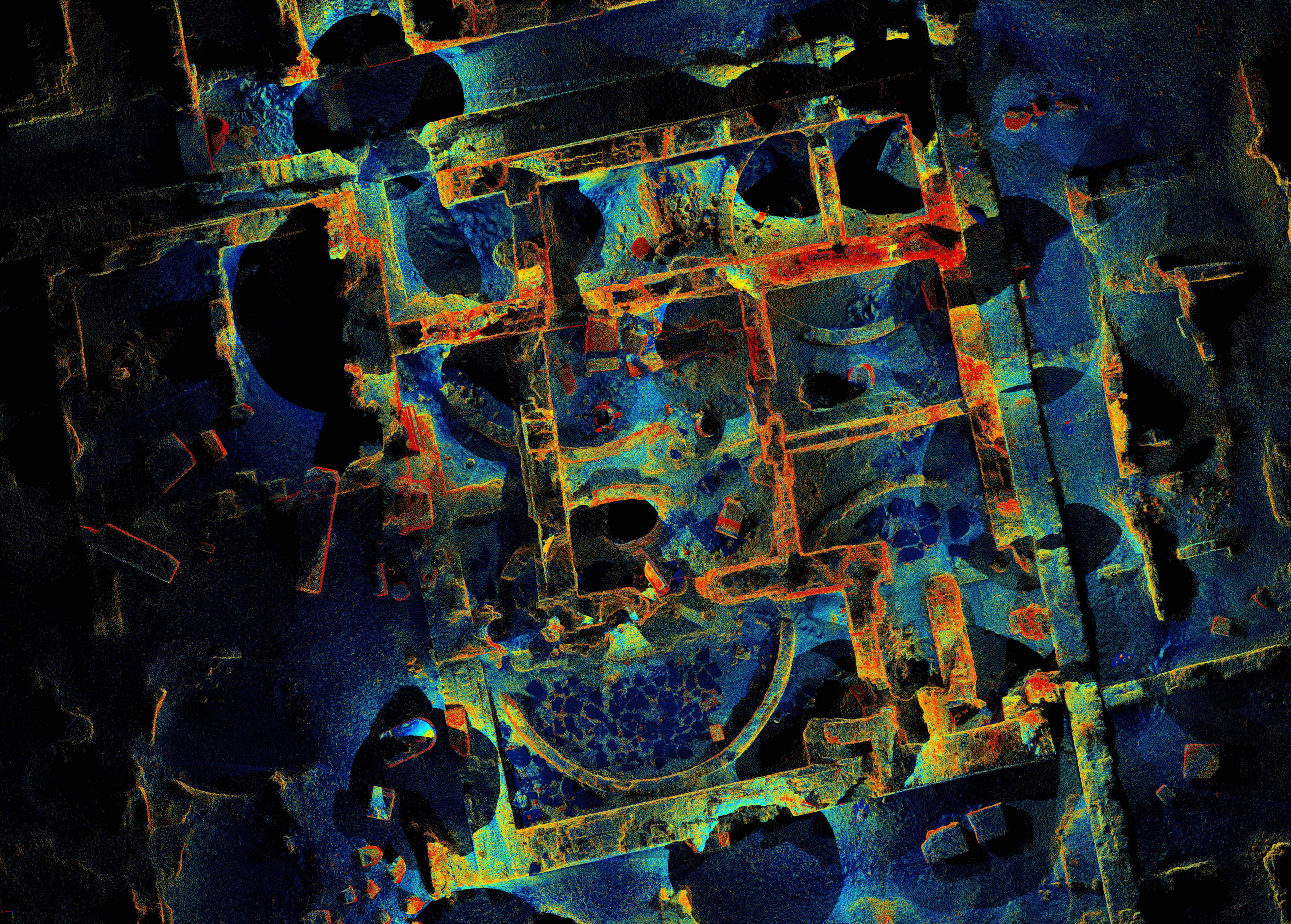
Ingrid Adenstedt has worked on the ground plan and also the 3D reconstruction of SAF2  – she convincingly showed that the building most likely had two storeys (Adenstedt 2016). Her reconstruction was also used in the animations of our recently published short film about the AcrossBorders project.

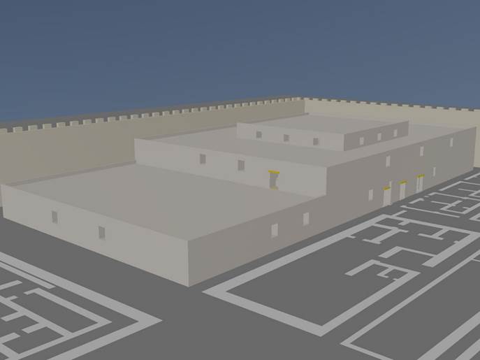
Reconstruction of SAF2, Ingrid Adenstedt 2016.

What also became evident by the reassessment of the so-called governor’s palaces within Egyptian temple towns in Nubia is the fact that despite of all their common characteristics (location within the town, two storeys, columned central hall etc.), a site specific approach considering the local topography as well as the functional aspects of the site (depending on its date of foundation, its specific situation, the local temples, the surrounding Nubian sites, the hinterland etc.) is essential for our understanding of these palatial buildings of the New Kingdom.

References

Adensted 2016 = I. Adenstedt, Reconstructing Pharaonic Architecture in Nubia: the case study of SAV1, Sai Island, Contributions to the Archaeology of Egypt, Nubia and the Levant 3, Vienna 2016. http://hw.oeaw.ac.at/7952-8inhalt?frames=yes.

Budka 2018 = J. Budka, Palaces in so-called Nubian temple towns: A reassessment, in: Manfred Bietak and Silvia Prell (eds.), Ancient Egyptian and Ancient Near Eastern Palaces. Volume I. Proceedings of the Conference on Palaces in Ancient Egypt, held in London 12th – 14th June 2013, Contributions to the Archaeology of Egypt, Nubia and the Levant 5, Vienna 2018, 251–273.

AcrossBorders monograph now freely available online

I am delighted that the monograph AcrossBorders I, dedicated to SAV1 North, is now freely available online.
The main focus of the book published in the OREA series Contributions to the Archaeology of Egypt, Nubia and the Levant by the Austrian Academy of Science Press is the physical remains of SAV1 North: the architecture and material culture, with emphasis on the pottery and small finds.
Datable to the mid- to late 18th Dynasty, the building phase labelled as Level 3 was the heyday at sector SAV1 North, well-attested by several architectural remains with associated finds and pottery, which are all presented in the volume. A summary of thoughts on possible hints about the lifestyle and activities at SAV1 North preserved in the material remains completes AcrossBorders I. All in all, the evidence from SAV1 North underlines the important role Sai plays in understanding settlement patterns in New Kingdom Nubia.
Of course all of us are very much hoping that the openaccess version of the book will be widely used, especially by users without access to Egyptological/archaeological libraries!

New monograph on the New Kingdom town of Sai

I am very proud to announce the publication of AcrossBorders’ first monograph!

The volume just published by the architect Ingrid Adenstedt presents the results of the building research undertaken on Sai Island in 2013 and 2014. It deals with the internal structure of the New Kingdom town at Sai Island, concentrating on the organization of the living space, the architectural outline and features of the individual buildings in the southern part of the site.

During two field campaigns in 2013 and 2014, the southern part of the settlement (SAV1), excavated by a French team in the 1950s and 1970s (see Azim 1975), was revisited and newly assessed, including a survey with a 3-D laser scanner as well as a building analysis. The results of this work are now being presented in the new publication. Next to a detailed description and building-historical assessment of the individual structures, the building remains are illustrated by manifold plans and 3-D reconstructions.

This volume is the first of a series of monographs as outcome of the START and ERC project AcrossBorders, and the architecture of SAV1 can serve as a sound basis for a deeper understanding of settlement patterns in Sai during the 18th Dynasty. The reassessment of SAV1, the southern part of the New Kingdom town of Sai Island, has produced several new results, which are relevant for a better understanding of the town layout.

I hope that the high efforts, meticulous and beautiful plans and 3-D reconstruction by Ingrid Adenstedt will be not only recognized, but will fulfil their desired outcome: to illustrate as one specific case study living conditions in respect to domestic space and Egyptian architecture in New Kingdom Nubia.

Reference:

Azim 1975 = M. Azim, Quatre campagnes de fouilles sur la Forteresse de Saï, 1970–1973. 1ère partie: l’installation pharaonique, Cahiers de Recherches de l’Institut de Papyrologie et d’Égyptologie de Lille 3, 1975, 91–125.

An Update on the Building Research

After taking part in two campaigns on Sai Island (see: The Architectural Survey Part 1 and Part 2 and the 3D-Laserscanning Campaign), I am now happy to announce that I have joined the team of AcrossBorders in the beginning of October, which enables me to fully focus on the architectural research of the New Kingdom town on Sai Island.

In the past months, my colleague from the Technical University of Vienna Robert Kalasek figured out a workflow for the post-processing of the huge amount of scan-data that we had acquired during our stay on Sai Island in February. This post-processing includes steps such as registering the single scans together and then cleaning the resulting 3D point cloud, i.e. removing any unwanted information and noises. After carrying out these steps and taking certain vital settings, such as the deviation, the range and the reflectance into consideration, a smooth data transfer into a further post-processing software was possible. In our case we are using the software PointCab, which enables us to create plans and sections directly from the 3D point cloud, which can be further worked out in AutoCAD.

Haus3 PointCab und Scan

3D point cloud of House 3 and plan of house 3 generated in PointCab

After Robert had already prepared some of the ground plans, my first task was to completely revise the ground plan that I had generated last year. The “old” plan was solely based on the sketches and measurements that I had carried out in my first year on Sai and therefore was lacking in accuracy in some parts. With the new laser scanning data, it was now possible to create an exact and – most importantly – a geo-referenced ground plan of the southern area of the Pharaonic town. At this point I would like to stress however, that my hand measurements and sketches were not in vain, since I believe that to really get to know a building and the structure you have to look really closely and carry out old-fashioned hand measurements to “get a feel” for it. Together with the 3D-data, these basics of documentation serve as the perfect combination for drawing analytical plans.

In a further step it is planned to integrate the newly excavated areas (SAV1 East and SAV1 West) as well as SAV1 North into this new plan. On the one hand, these areas were also scanned and geo-referenced, on the other hand they were exactly documented in the course of the excavation. Both of these results can easily be incorporated into the final map of the area. Also, work on detailed plans on the respective buildings in the form of accurate stone-by-stone (or rather brick-by-brick) plans has commenced and will be continued over the next few weeks.

scanuebersicht_OST01

3D scan of Building A (SAV 1 East)

Since a major part of my future work will focus on a reconstruction/visualization of the New Kingdom town, which shall have a strong scientific basis, I have started to look for comparative architecture in other settlements, e.g. Amarna and Elephantine in Egypt or Amara-West, Askut and Sesebi in Sudan. Different aspects of settlement architecture have to be taken in account, such as residential and administrative buildings, storage facilities, the fortifications and the entrance gate. The specific layout of the towns is being investigated as well, so that possible new conclusions for Sai can be made, especially taking into account that of now we still know little of the northern part of the town.

Going into more detail, other aspects I wish to elaborate on are the specific building types and also the building techniques used at the different houses.

H3_Überblick von Nord

House 3 as an example of a specific building type on Sai Island

In conclusion I can say that I am very much looking forward to the upcoming months and working with the architectural remains of Sai Island, which is certainly a very exciting field of work!

Looking back on the 3D-Laserscanning Campaign on Sai Island

Even though we have already been back in Vienna for some time, I would like to give some information on the 3D-laserscanning campaign, which was carried out on SAI Island from February 3-10, 2014. Robert Kalasek from the Technical University of Vienna was the main person in charge of the scanning process, providing his know-how and years of practical experience in the field of 3D-laser scanning. My part was to provide technical and scientific assistance, letting the knowledge acquired from last year’s architectural survey flow into the work process.

The main goal of the work was to obtain a complete geometric documentation of the remaining walls and floors of the southern part of the New Kingdom town on Sai Island. 3D-laserscanning seemed to offer the most comprehensive result which could be achieved in a relatively short time.

For the scanning an Image Laser Scanner Riegl VZ-1000 was used, a Nikon D800 camera with a 14 mm lens was mounted on the scanner in order to record the texture. During the scanning process a grid of three dimensional points is automatically measured in the surveyed area by the instrument. So-called 3D point clouds result from this process, including xyz-coordinates and an intensity value depending on the surveyed material.

IMG_1064

Image Laser Scanner Riegl VZ-1000 in front of the ruins

The complete scanning of the remains of the Pharaonic town required 155 different scan positions, whereby the maximum distance of the measured points ranged between 200 and 400 m, according to the angle of incidence and the reflectivity of the material. The result of each scan is a point cloud in a local coordinate system. In a next step, the scans can be joined (registered) with the help of a multitude of reflector points, which were distributed throughout the ruins. Generally, at least five overlapping points are needed in order to put two scans together. These reflector points were also measured with a total station so that the registered scans can be placed into a geo-referenced net. With the help of the intensity information one can encode the three dimensional point clouds with different colors, which is often sufficient to differentiate the various objects.

ansicht_mitte

Scan of part of the storage rooms of the Pharaonic town with different colors for the intensity of the textures

In addition to the standing remains of the Pharaonic town, the newly excavated trenches (SAV1 East and SAV1 West) as well as SAV1 North were also scanned and geo-referenced. In order to collect data for the topographic understanding of the surroundings, four long-range scans (range: 1.2 km) from elevated points were also undertaken. This could maybe help in understanding the general topography of the town and also to clarify questions such as the course of the city wall on the eastern side of the town.

scans_auswahl_aus_allen_projekte_2pt_03_25prozent

Overview of the entire area of the Pharaonic town compiled from selected scans

Looking back on our days on Sai Island, I am happy to say that our campaign proved to be very successful and everything worked out as planned. Luckily, we had very few nimiti-days and the strong winds did not affect the stability of the scans as much as we had feared. The work-flow was very smooth and even though the work load was intense, especially for Robert, who worked on the data acquired during the day every evening until long into the night, we left Sudan with a lot of positive energy.

Next to the final registration of the scans, the post-processing in Vienna now entails the preparation of the data, e.g. reducing the enormous amount of data and refining the registration. The final output, a geometrically accurate three-dimensional model, can be used in the future to produce scaled plans and sections and a terrain model. It can also serve as a basis for further analyses and the creation of a reconstructed visualization of the Pharaonic town.

More Observations from the Architectural Survey

The architectural survey of the southern part of town proved to be very successful and many new observations could be made as well as old ones verified. Back in Vienna, the sketches and measurements taken on Sai will be integrated into a new map of the New Kingdom town and the written observations will be compiled into a so-called room book.

H1_5_Korridor von Süd

Overview of the residential buildings showing the grid-like pattern

Overall it can be said that the buildings in this part of the Pharaonic settlement were apparently well planned and executed. The walls are throughout perpendicular to each other, forming rectangular rooms and a strict grid of houses and streets.

SAF2_Bautechnik

Detail of the brick-laying technique

The building technique of the walls is very homogeneous as well: basically, only two brick formats were used, larger ones with 40x19x9cm at the so-called palatial building and smaller ones with 33x17x8cm elsewhere.The applied brickwork also always follows a similar pattern. One course of bricks consists of facing stretchers followed by a number of headers according to the thickness of the respective wall. In the alternating course, the stretchers were placed on the other side of the wall. Large gaps were left between the bricks, which could be up to 10cm wide. The thickness of the walls varies from about 54cm to 106cm, whereby one can assume that the houses with thicker walls had a second storey.

Of special note is the large residential building in the eastern part of the town. Apart from its considerable size, the execution of the brickwork and the building details sets it apart from the other dwelling units. The building had a central hall with six columns – two of the column bases are still in situ – and floors in the main rooms made of brick which were laid into a special pattern. The finely cut sandstone thresholds are further proof of the high standard of this residence.

SAF2_Raum 3 von West

Entrance into the so-called palatial building

Raum9_Boden

Brick floor of the palatial building

A Brief Update on the Architectural Survey

DSC_5173The architectural survey and the reexamination of the southern part of the Pharaonic town of Sai Island continues as planned. Its current focus lies on the eastern part of the area with a prominent large structure, the so-called palatial building featuring a large hall with columns. Floor DSC_5193levels and pavements are partly well preserved and the zone is very interesting, but also highly complex.

Making detailed sketches and taking measurements of structures, walls and mud bricksDSC_5184 are the main daily working tasks of our architect Ingrid Adenstedt in order to reassess the town plan.


The Architectural Survey

Apart from the newly excavated area, one focus of this year’s campaign lies in the reexamination of the southern part of the town which was uncovered in the 1970ies by M. Azim. In this area, the remaining walls are in parts preserved up to 2-2.5 m.

The original layout of the New Kingdom settlement can be traced very well here: inside a massive fortification wall with the main entrance gate situated on the western side and facing a temple (Temple A), the streets and houses are laid out in a grid-like pattern with distinctive quarters for the administrative buildings, residential houses and storage rooms.

H_overall view01

Overview of the residential quarter of the New Kingdom town

The task of this year’s three week long architectural survey of the area is to take a closer look at the remains and to reassess the results and observations made in the 1970ies. In the first week, the work focused on the storage area. While in the northern and southern part longitudinal storage rooms were built over the remains of round silos, the central part of this town quarter presents itself as more complex: here, at least four building phases can be detected, considerably changing the original layout of this storage area. In the last phase, housing units were possibly built into the former storage rooms.

Remains of a storage silo

Remains of a storage silo

New Kingdom door post reused as a threshold

New Kingdom door post reused as a threshold

The method of work as of now is to make detailed sketches and to take measurements in order to enhance the city plan made in the 1970ies. This and the compilation of a catalogue of each room shall serve as a basis for further research. In the remaining two weeks of the survey, the focus of the work will shift to the residential quarters. A closer look shall also be taken on the various building techniques applied in the different areas of the town.