Geoarchaeology from Sai Island, 2016

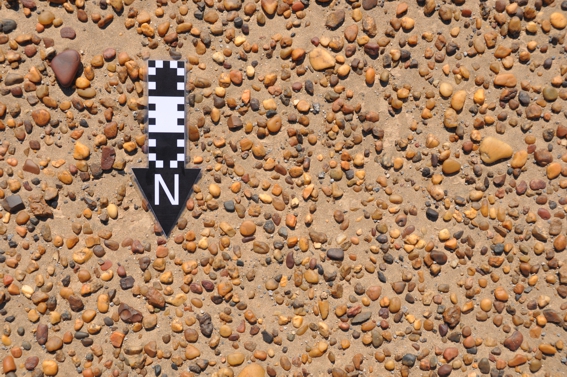
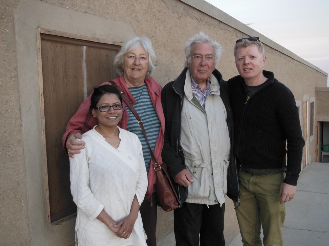
What a geoarchaeological season it was! We haven’t gotten over it as yet and can foresee a year of excitement in the lab(s). No, we did not have quite a romantic relationship with the nimitis who were just starting to cuddle up with us when we left the place. Instead it was a season of fun involving sampling from within the trenches to better understand the use of space and site formation processes, of provenancing the sandstones found within the Pharaonic town and locating the New Kingdom sandstone quarry and overall placing the 18th Dynasty remains in their environmental context.

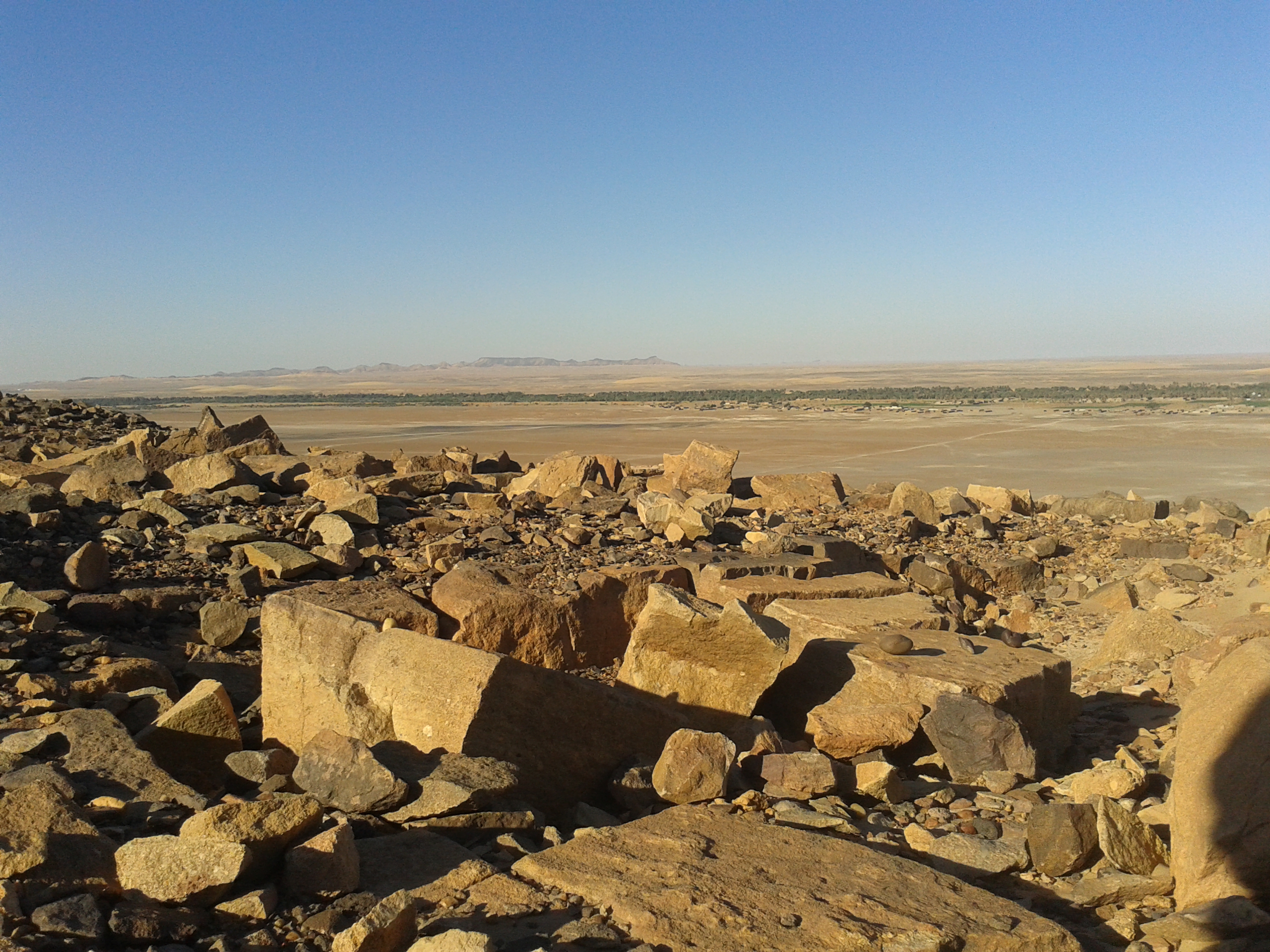
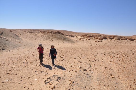
One of the main focuses of this year’s fieldwork was directed on locating the source of building stone for the New Kingdom stone buildings. In this respect, we had received helpful assistance by Prof Klemm and Rosemarie Klemm. A detailed survey was carried out both within and outside the island. No quarry site from Pharaonic times, however, was found outside the island, in the vicinity of the sandstone outcrops of Gebel Abri. On the other hand, several quarries in the sandstones were identified adjacent to the New Kingdom town itself!

With the Klemms 1When scrutinised more carefully with Professor Klemm’s long experience of Pharaonic sandstone quarries, analogous chisel marks have now been identified on the sandstone outcrops of the quarries and on the blocks of stones used in the temple. Here, we would like to thank Martin Fera for lending us his geological hammer, about which we would ALL somehow manage to forget from time to time, thus creating much commotion, laughter and fun amidst our fieldwork.

Sandstone quarry with New Kingdom chisel marks 1
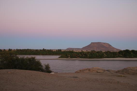
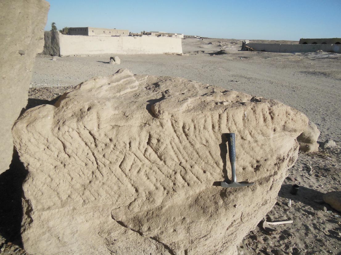
This year’s survey also produced further suggestion about the Pharaonic harbour or landing ground in the adjacent alluvial platform when rock-cut features for tying ship ropes were found at least at two places. In addition, rock cut steps bearing chisel marks identical to those of the temple have also been identified.

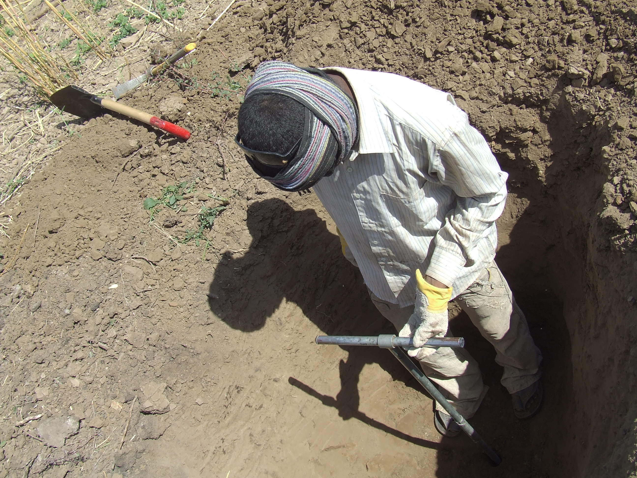
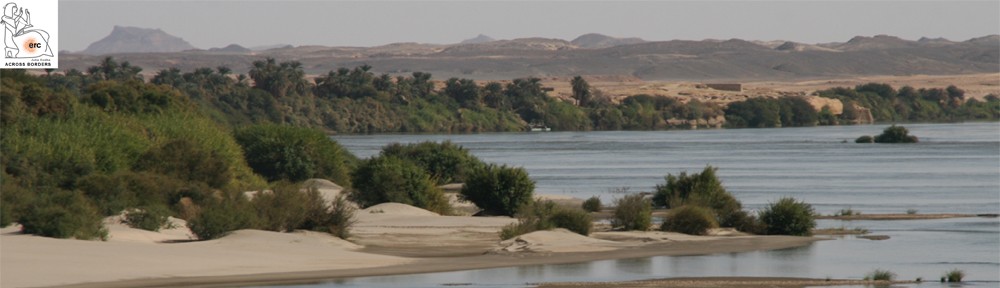
In addition, six boreholes were dug towards the western side of the Pharaonic town. This has revealed no trace of an extramural settlement where sampled. 4.5mts of hand auger 1A thorough landscape survey has also been undertaken to understand the nature of the deposits, especially towards the northern part of the island. This has enabled us to collect data to develop a surface map of the vicinity of the town. Along with the data from the hand auger profiles, exposed sections, soil micromorphology and the surface map, a better understanding of the site setting and geomorphology of the location can be integrated within the GIS for various purposes.

The grass is always green on the other side. Now that we are back at home in the dark and cold, we are longing for some sunshine and clear sky like that of Sai. Knowing that is not a possibility at the moment, we are at least happy that we have a good load of micromorphological and petrographical samples to analyse through in the coming months.

Some geoarchaeology in and around Sai Island

It is somewhat unusual when you are just 150cms tall, a female with a different skin colour, wearing uncommon attire, do not speak the language and are moving around alone in the desert with a knife and a hammer. Infrequent passersby in their cars or on their donkeys stop by and ask you whether you are lost or not! Well, that exactly what had happened when I, a geoarchaeologist, had been working in and around the New Kingdom temple Town of Sai Island. I joined the AcrossBorders team during the field season of 2015 and what an interesting season it had been!

I undertook geoarchaeological survey in the vicinity of the site. I was mostly assisted in the field by Hassan Dawd, a local from the island and since many years one of the best workmen assisting in the field. Not only did he take a keen interest in digging holes as per my instructions, but was of utmost help in keeping the dreadful date flies (called nimiti in Sudan) away by burning donkey dung, so as to allow me to concentrate in my job. Well, in that respect I can point out that the donkeys have also been very supportive. I was also occasionally assisted in the field by various other team members namely Miranda Semple and Martin Fera.

Test pitting and hand augering going on in the alluvial platform adjacent to the site.

Test pitting and hand augering going on in the alluvial platform adjacent to the site.

During the 2015 field season at Sai, I was assigned with objectives of placing the archaeological site in its environmental context, to understand the nature of any surface preparation prior to the establishment of the settlement, provenance of sandstones found within the Pharaonic town, potential sandstone quarry locations and to shed light on any possible harbour/landing ground on the island during the period concerned. To try to have some answers for these objectives I conducted test pitting, hand auger profiles (I somehow tend to relate this Dutch auger with a magic-wand; not only there is a visual similarity but also this can create absolute magical interpretation out soil profiles) and of course looked out for exposed and available sections and quarry pits. At each profile loci, the stratigraphy was located, recorded and photographed and old land surfaces sampled as appropriate. Three types of samples were taken: intact soil block samples for micromorphological analysis, small bulk samples for physical characterisation (pH, particle size analysis, organic content using loss-on-ignition, multi-element analysis) and sand-stone blocks for petrographic analysis.

Six profiles were recorded from the landscape survey and seven sets of soil block and bulk samples were collected. In addition, from Profile 9 in SAV1 N, two sets if soil block and bulk samples were collected from below the contact zone of the anthropogenic sediments and natural soil. Besides these, thirty-nine rock samples have been collected for further scientific analysis from different sandstone outcrops of the island and from on-site debris. These outcrops are mainly at Jebel Adou and the village of Adou, where at least 4-5 quarry places (unsure of the period of quarrying though) have been marked. The aim behind collecting sandstones from on-site debris was to provenance their sources by characterising their mechanical and chemical properties.

 Remains of sandstone quarrying at Sai Island.

Remains of sandstone quarrying at Sai Island.

Now I very much look forward to process all these samples and to have a rich pool of data. My sincere thanks to Julia all the other team members for making work so easy. We will keep you updated about our geoarchaeological findings.

Sai Island 2014: Geoarchaeological investigations

The aim of the geoarchaeological fieldwork within the framework of AcrossBorders was to expand our knowledge about the existing rock types, their relationships, Quaternary sediments, geomorphological evolution and estimations about possible Nile erosion processes at the site of the Pharaonic settlement. The scarcity of vegetation, presence of riverfront exposures as well as excellent outcrops provided by excavated graves offer great geoarchaeological working conditions.

Sai Island is situated between the 2nd and 3rd Nile cataracts, which are a result of a large scale east-west trending tectonic uplift zone, which forces the Nile to incise into uplifted Neoproterozoic crystalline basement and its sedimentary cover (Thurmond et al. 2004). Consequently, Sai Island comprises medium-grade metamorphic Precambrian rocks (amphibolite, dolomite, quartzite, biotite gneiss, calcite marble) in the west and southeast, dipping around 30° towards the Northwest. These rocks are commonly cross-cut by large quartz-veins.  In the central and northern part of the island these meta-volcano-sedimentary rocks are overlain by subhorizontal Nubian Sandstone, mainly consisting of medium- to coarse-grained fluvial quartz sandstone, conglomerate, rare siltstone and occasional silicified wood.

Yellowish Nubian Sandstone overlying dark amphibolite in the southeast part of Sai Island

Yellowish Nubian Sandstone overlying dark amphibolite in the southeast part of Sai Island

Almost all of these rocks are covered by thin layers of comparably much younger Nile sediments (in some places with Palaeolithic artefacts) and only the Nubian Sandstone of Jebel Adu raises as an Inselberg from the flat terraces surfaces (van Peer et al. 2003, Anonymous 2005).

Example of small basement outcrop in the more fertile West of the island

Example of small basement outcrop in the more fertile West of the island

The pre-Holocene Nile sediments mainly comprise gravely channel deposits and fine-grained floodplain sediments. The sub-rounded to rounded gravel of the pre-Holocene Nile terraces are strongly dominated by quartz clasts, followed by chert and beautiful agate and virtually free of carbonate clasts, while the fine-grained floodplain sediments commonly show soil formation processes and related calcrete (Lewis et al. 2011).

Photo showing typical composition and grain-size of gravelly terrace surfaces

Photo showing typical composition and grain-size of gravelly terrace surfaces

The rock types occurring at the site of the Pharaonic settlement in general reflect the geological reality of the island and most of them are locally available. By far the most common rock types are quartz sandstone and amphibolite, while vein quartz, calcrete, biotite gneiss, calcite marble are comparable rare. Rock types which probably have been brought to the island include granite, diorite, gabbro and gypsum.

References:

Anonymous, Geological map of Sudan. 1 : 3,500,000, Geological Research Authority of the Sudan, Khartoum, 2005.

J. Lewis, J. Smith, & E. Garcea, Paleoenvironmental implications of the isotope geochemistry and granulometry of Quaternary alluvial sediments and paleosols from Sai Island, Sudan. GSA Annual Meeting, 9-12 October 2011, Minneapolis, abstract, 2011, 95-19.

A.K. Thurmond, R.J. Stern, M.G. Abdelsalam,  K.C. Nielsen, M.M. Abdeen & E. Hinz, The Nubian Swell. Journal of African Earth Sciences, 39, 2004, 401-407.

P. Van Peer, R. Fullagar, S. Stokes, R.M. Bailey, J. Moeyersons, F. Steenhoudt, A. Geerts, T. Vanderbeken, M. de Dapper & F. Geus, The Early to Middle Stone Age Transition and the Emergence of Modern Human Behaviour at site 8-B-11, Sai Island, Sudan. Journal of Human Evolution, 45, 2003, 187-193.

Landscape archaeology and environmental remains at Sai

Simply a perfect start into the New Year – we arrived safely yesterday on Sai Island, early enough to enjoy the beautiful sunset!

IMG_1241Today we got settled and are currently preparing everything to start excavating on Saturday. With the beginning of 2014, I have furthermore the pleasure to welcome two new team members of AcrossBorders, both of them will also join us in a few days on the island.

Erich Draganits studied Geology and Prehistoric Archaeology at the University of Vienna. Within the Earth Sciences he is specialized in clastic sedimentology, deformation of sediments, landscape evolution and Earth surface processes. Based on his expertise and interest in interdisciplinary research he carries out geoarchaeological studies at numerous archaeological excavations including diverse sites, periods and countries like Austria, Italy, Greece, India, Turkey and now also Sudan.

This January, Erich will conduct a first geoarchaeological survey (including drilling and test pits) on Sai – investigating the harbour situation, geological formations, sandstone quarries and more. He will closely cooperate with Konstantina Saliari and also Giulia d’Ercole who is investigating the clay deposits of the island related to her research on the local pottery production.

Konstantina Saliari is the second newcomer. She has studied archaeology and prehistoric archaeology at Athens where she received her MA in 2011. She is currently a PhD student of the University of Vienna and has joined AcrossBorders as researcher specializing in zooarchaeological remains. In the upcoming season, Konstantina will work on animal bones coming from the site of SAV1N within the New Kingdom town of Sai.

Environmental and climatic settings and changes are important issues for our research questions and the aim to reconstruct living conditions at Sai Island during the New Kingdom. We aim at estimating the human interaction with the landscape and will tackle the question of the location of settlement areas and cemeteries over the ages. Assessments of real living conditions in the past are essential to understand the relations of the Egyptians living on Sai with the indigenous Nubian population.

Just one small example – from Egyptian texts, temple reliefs and wall paintings we have plenty of evidence that various wild and domestic animals were imported to Egypt from Nubia.

Davies & Gardiner, The tomb of Huy, Theban Tomb series vol. 4, pl. 48: Boat with cattle from Nubia, being brought to Egypt.

Davies & Gardiner, The tomb of Huy, Theban Tomb series vol. 4, pl. 48: Boat with cattle from Nubia, being brought to Egypt.

At least five different types of cattle are mentioned in the texts! For example, the beautiful paintings in the tomb of viceroy Huy at Thebes show jw3-cattle being brought from Kush. It is intriguing whether there are possibilities to reconstruct differences between cattle also in reality, using the corresponding bones. How do the actual remains relate to the texts and pictoral representations of Upper Nubian animals in general? What kind of wild and domestic animals can we trace at Sai Island and can we estimate their numbers?

Davies & Gardiner, The tomb of Huy, Theban Tomb series vol. 4, pl. 23: jw3-cattle are brought from Kush.

Davies & Gardiner, The tomb of Huy, Theban Tomb series vol. 4, pl. 23: jw3-cattle are brought from Kush.

Joint research by Erich, Konstantina and others will help to understand the environmental conditions on Sai – the expected new data will allow putting the island in a broader context and can also adress very detailed questions about living conditions in Kush.

I am very happy to welcome Erich and Konstantina as new team members, looking forward to their first results this season!