As posted recently, some new observations about the town layout of the New Kingdom Sai are possible thanks to AcrossBorders’ archaeological fieldwork on Sai Island from 2013 until 2017. In a short summary, now available for free online, I stressed that our archaeological excavations were complemented with kite aerial photography, structure from motion approaches, terrestrial 3D laser scans, geoarchaeological surveys, micormorphological soil sampling and various archaeometric analyses of diverse materials. Naturallly, much potential derives from this combination of methods and approaches.
The recent 2017 field season on Sai Island provided some answers to both general research questions, e.g. about the occupation of Sai during the 18th Dynasty, but also to more detailed questions like building phases within individual sectors. Excavations in sector SAV1 East resulted in particular in new insights on the layout and function of the New Kingdom town.
Large subterranean storage rooms were unearthed in rooms with schist floors, stressing the role of Sai as Egyptian administrative center during the mid-18th Dynasty. The new cellars (Feature 83 and 85) and corresponding rooms are comparable to the southern sector of the town, excavated by a French Mission in the 1970s and recently re-studied by Ingrid Adenstedt.
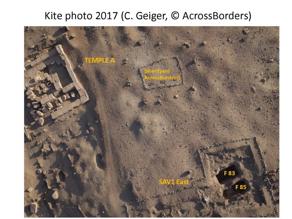 Feature 83 and 85 are probably related to the Egyptian stone temple, Temple A, close by. With our new fieldwork, the town map can therefore be updated and fresh remarks on the internal structure are possible.